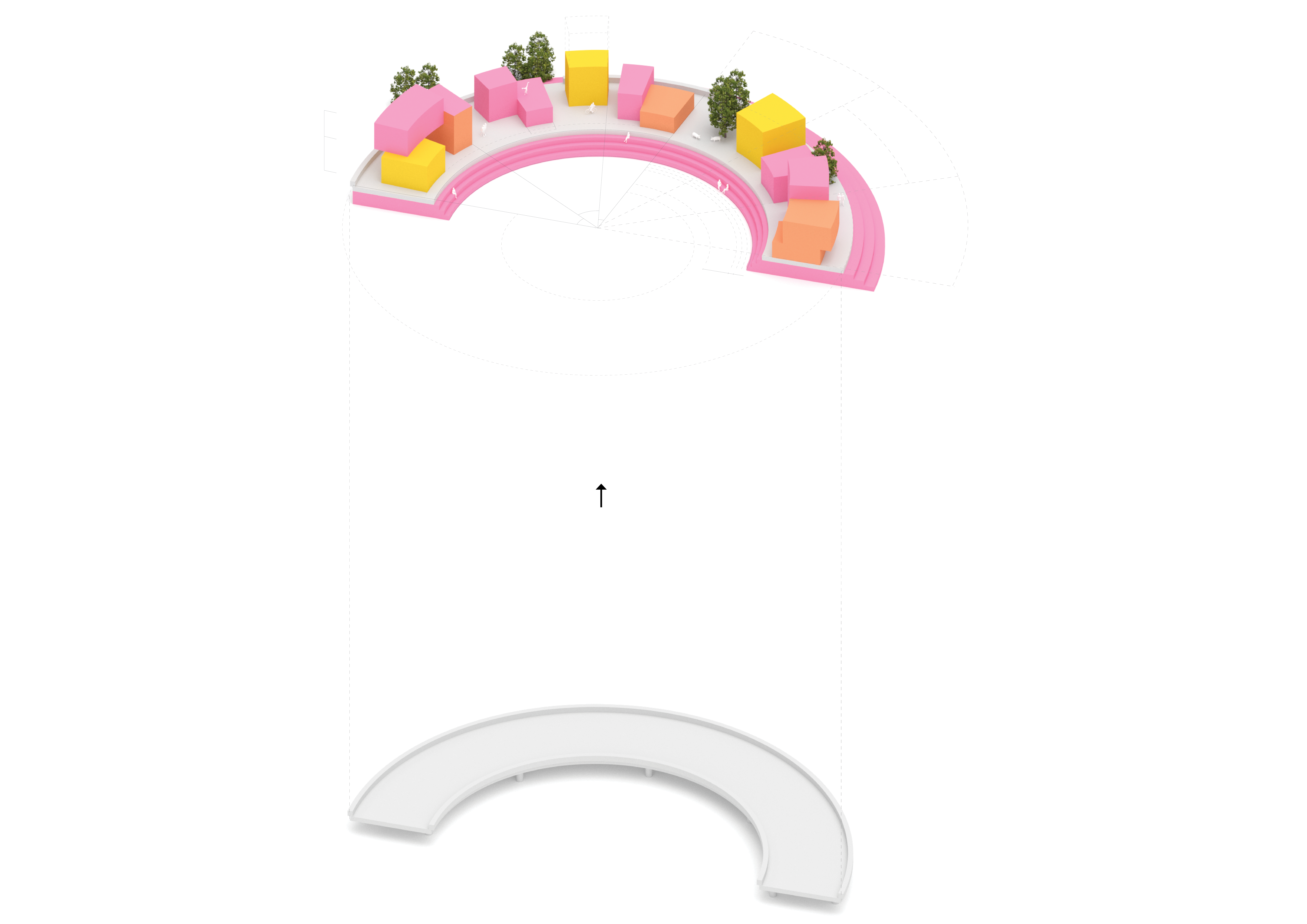
BACKGROUND
Modern cities are centralized around the car, with streets, avenues and highways pulsing through the city’s most central locations. They represent a network of barriers and potentials. In a shift to a public space city, these structures would undergo transformation. Some would be considered obsolete remnants of history whereas some would be readapted for a new purpose. This thesis aims to, in a speculative manner, investigate and visualize the potential of such transformation. The research is conducted through a series of spatial experiments with both general and site specific approaches. It investigates what inherent value these structures might hold when gradually transformed and how they can be imagined as catalyzers for new hybrid typologies and urban synergies.
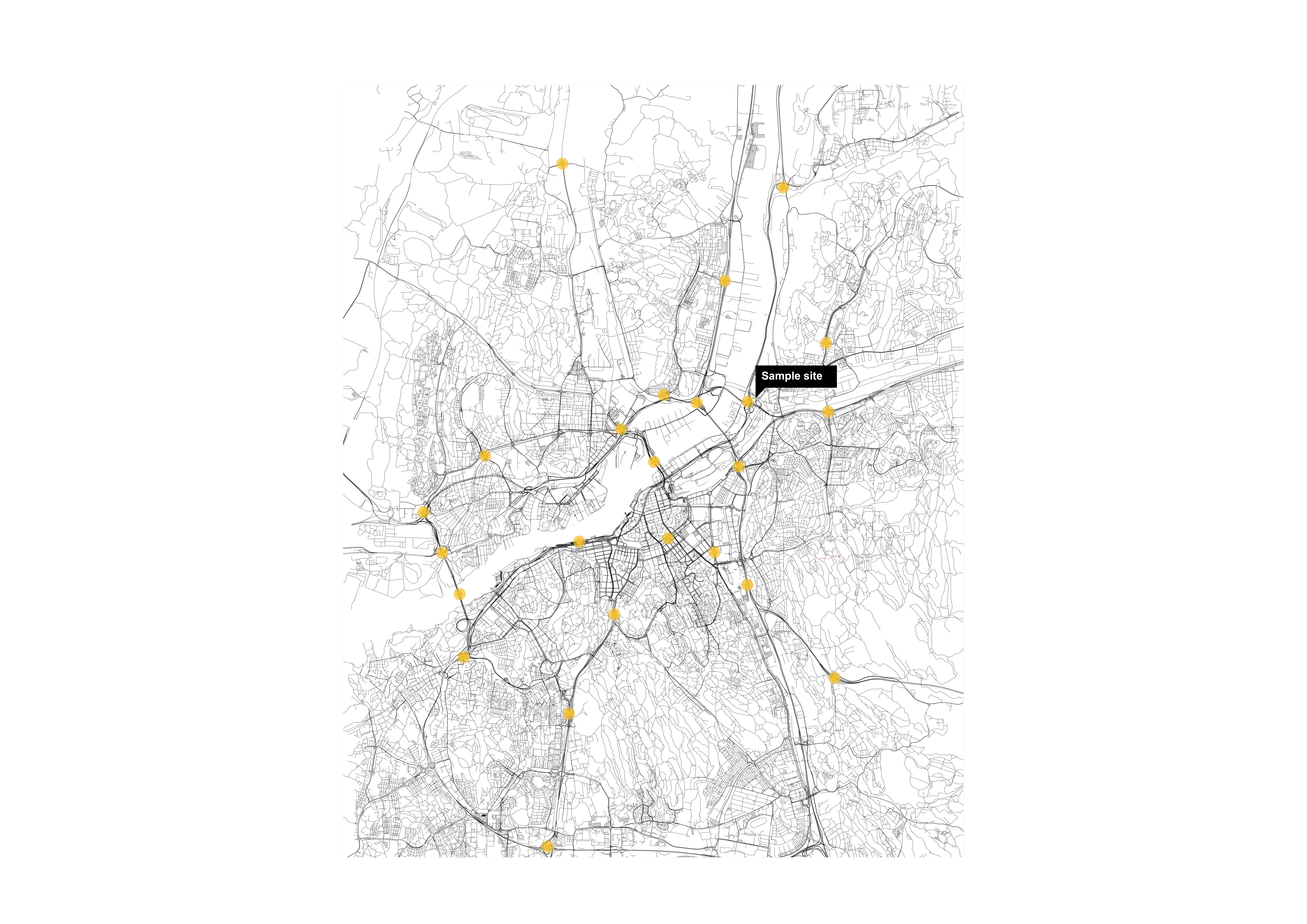
GOTHENBURG HAS SEVERAL INFRASTRUCTURAL NODES THAT POTENTIALLY COULD BE TRANSFORMED AND UTILIZED AS URBAN RESOURCES.
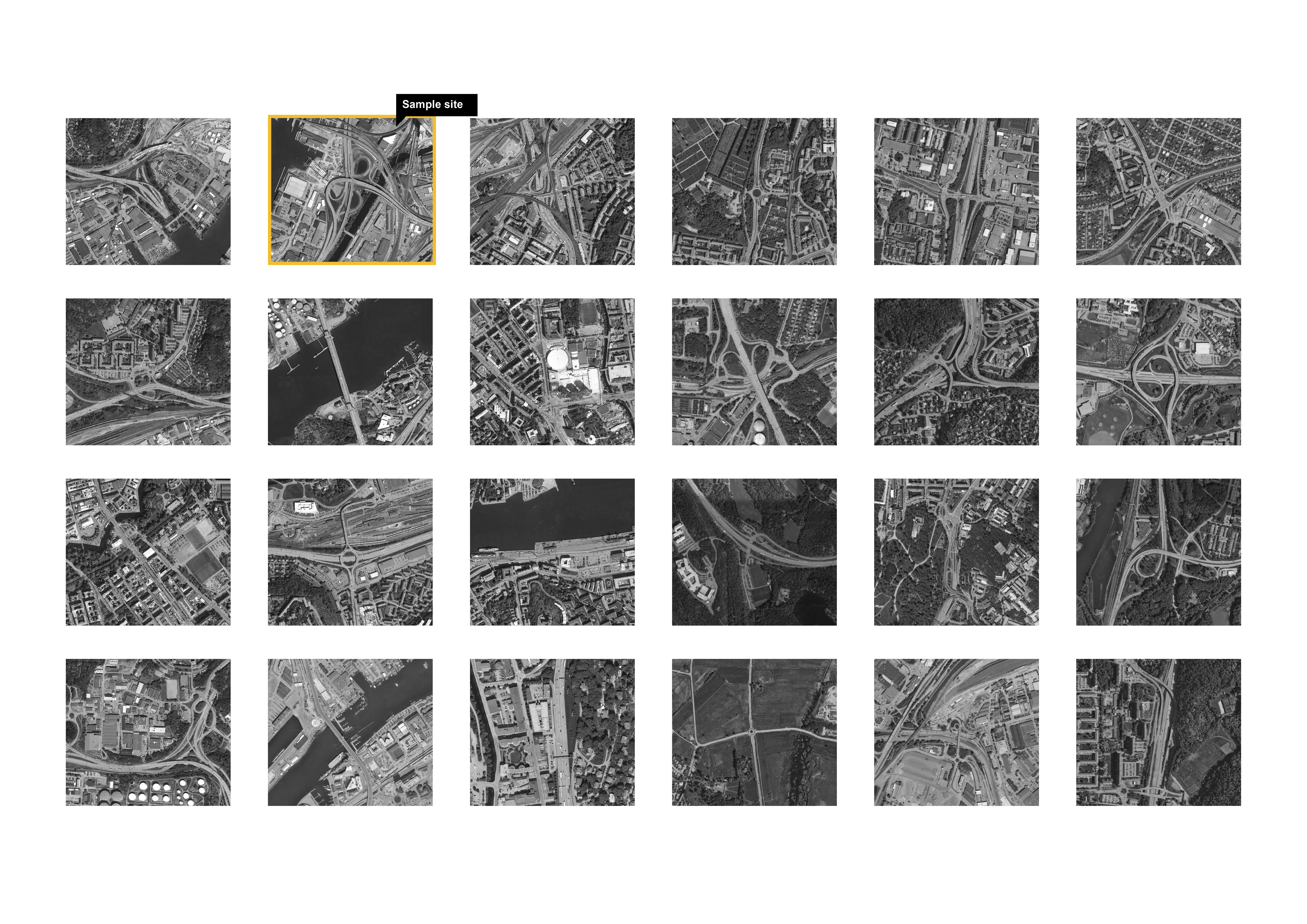
METHOD
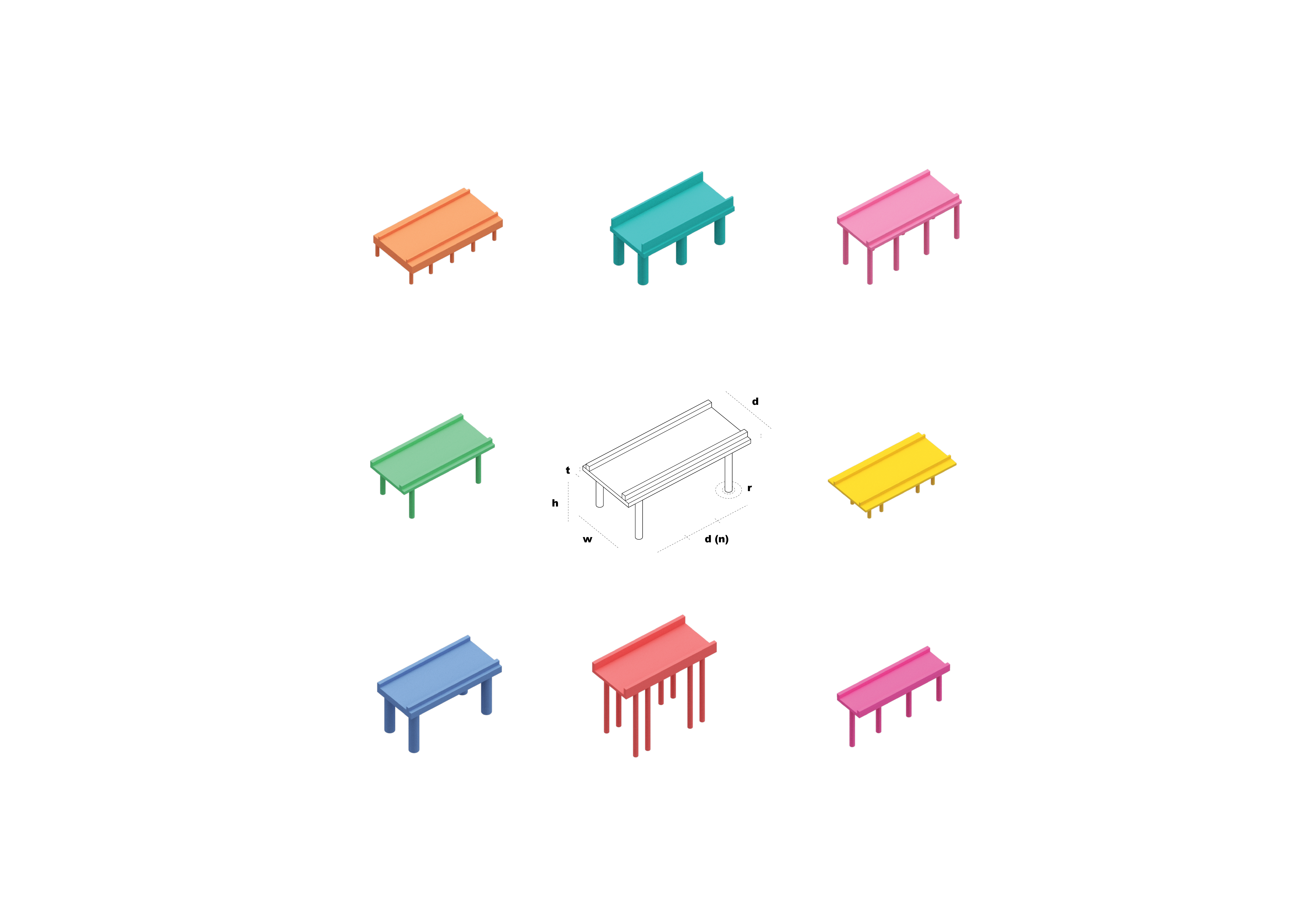
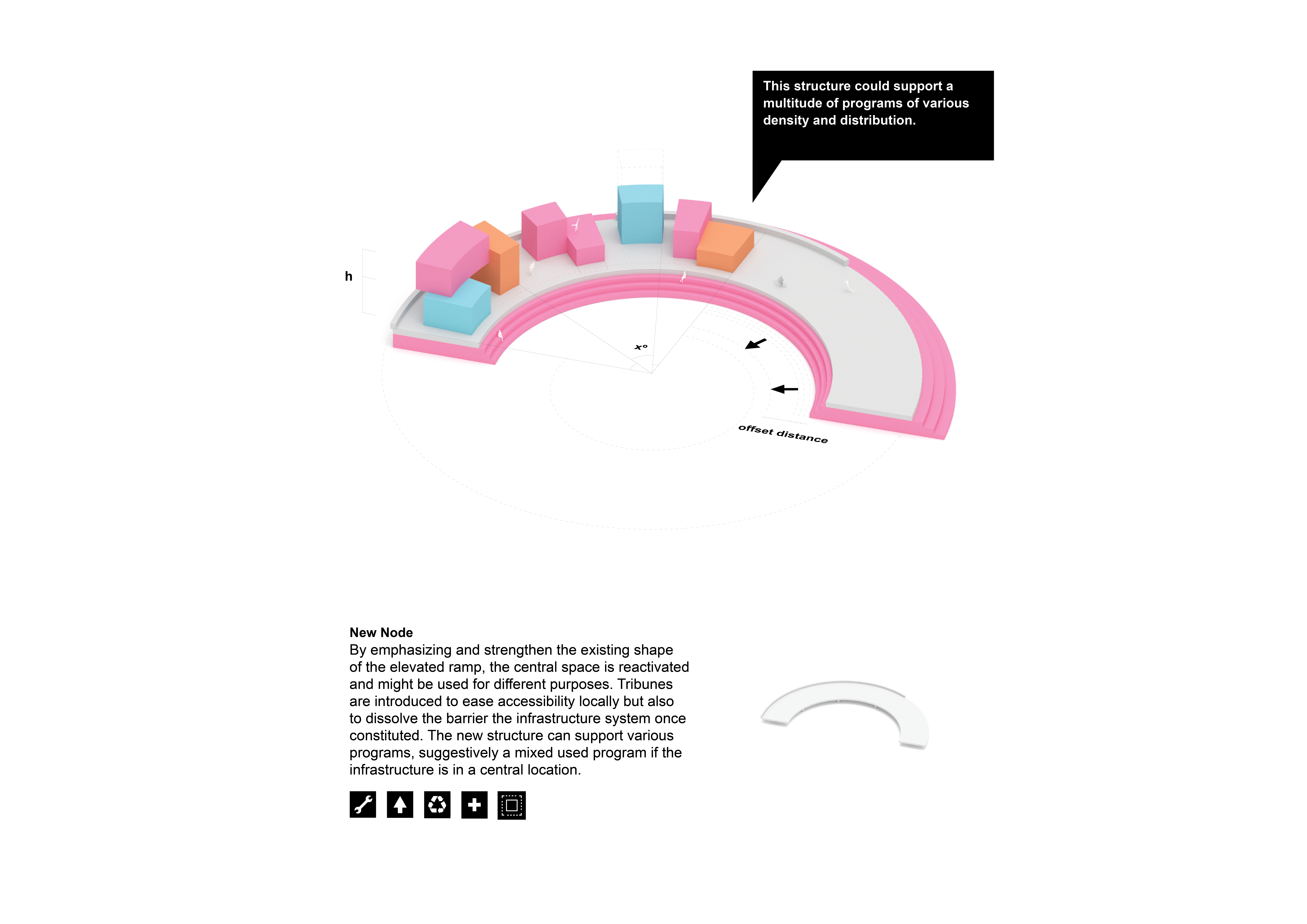
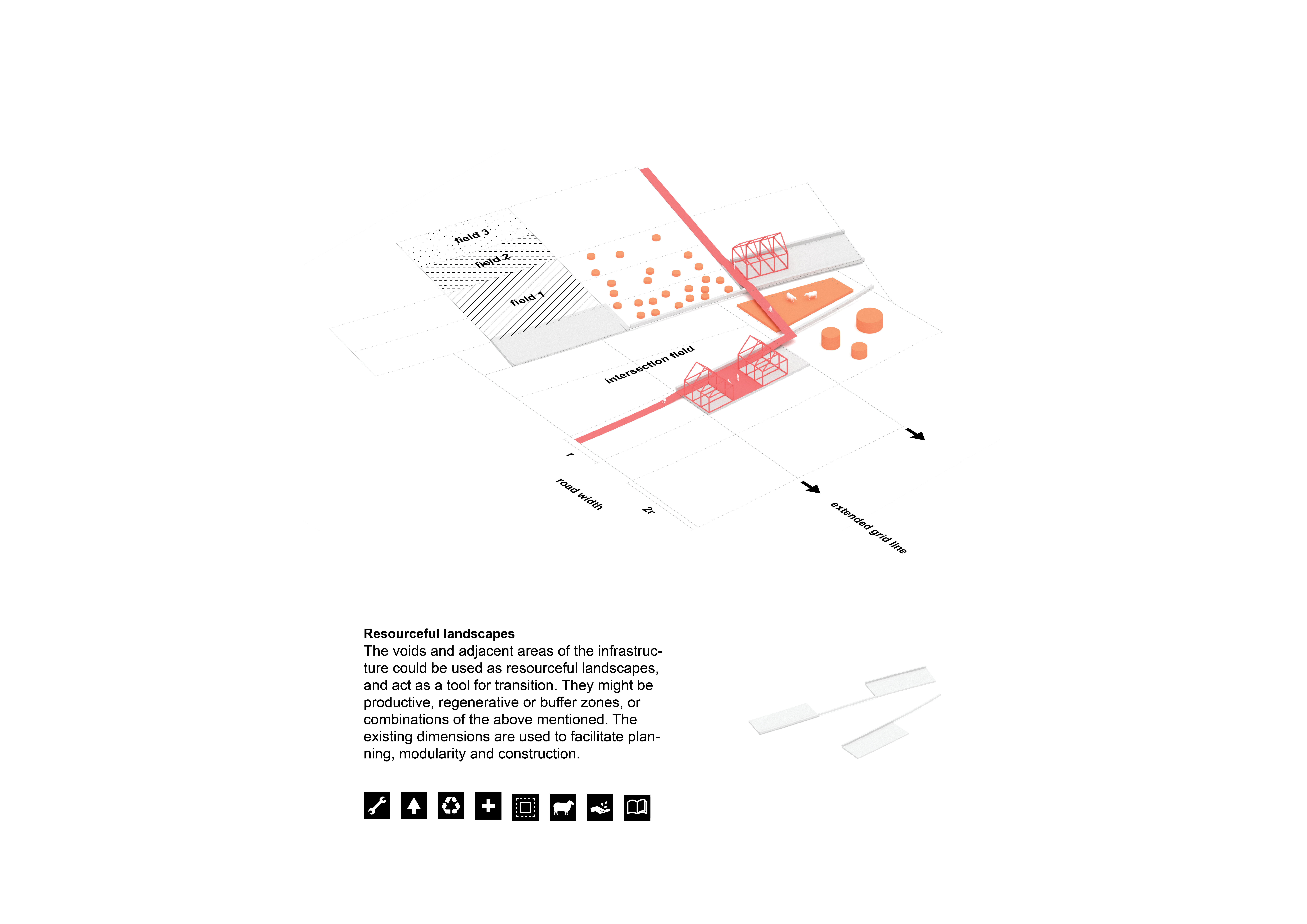
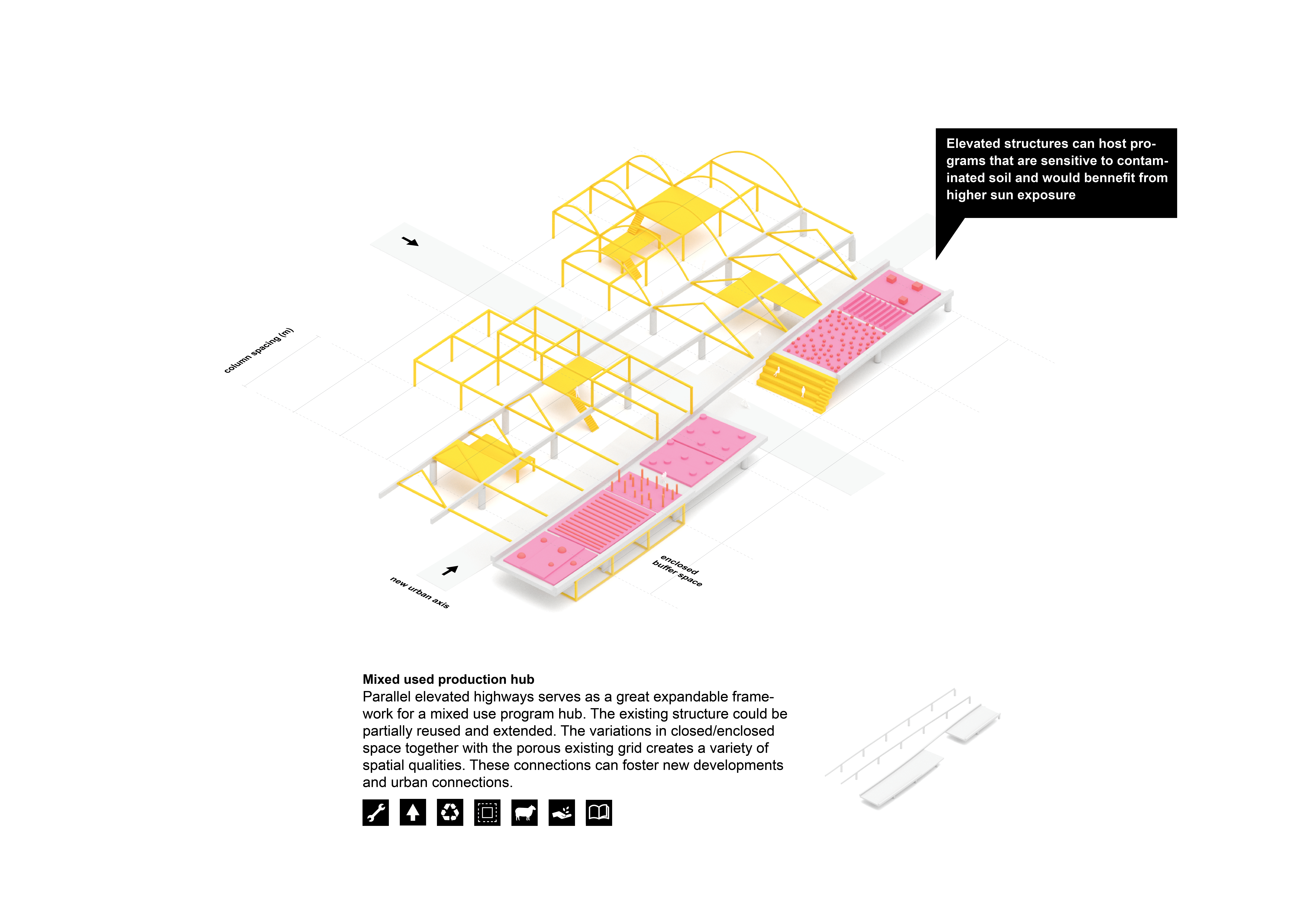
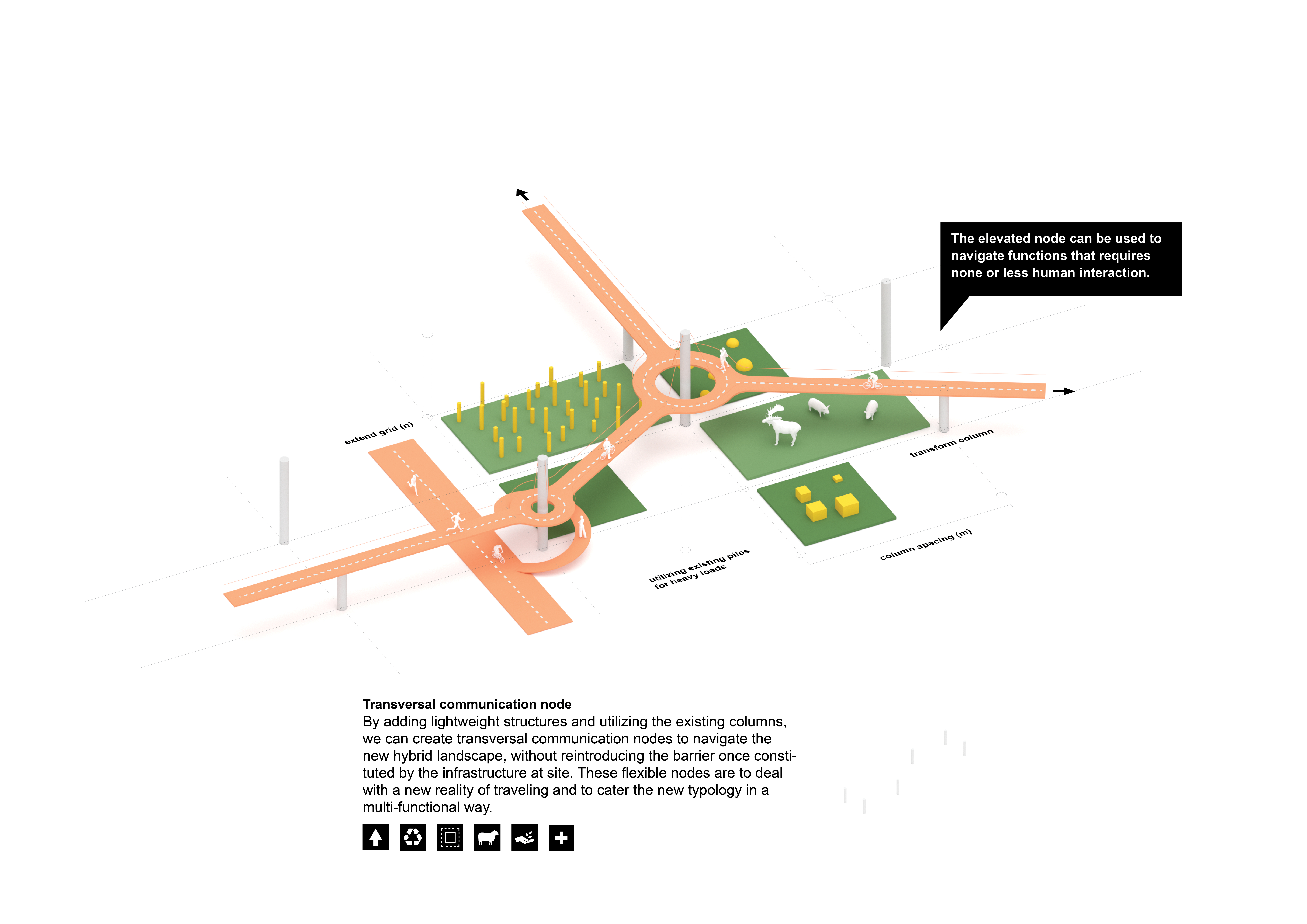
To imagine how these spatial potential could be released. I created a script that would gradually reduce and dissolve the previously observed obsolete infrastructure typologies. The script is a parametric model with the ability to represent different infrastructural settings in terms of dimension parameters.

AND EVENTUALLY HOW THE OBSERVED SPATIAL ELEMENTS COULD BE USED TO HOST NEW URBAN FUNCTIONS AND ULTIMATELY BE PART OF A NEW URBAN HYBRID TYPOLOGIES
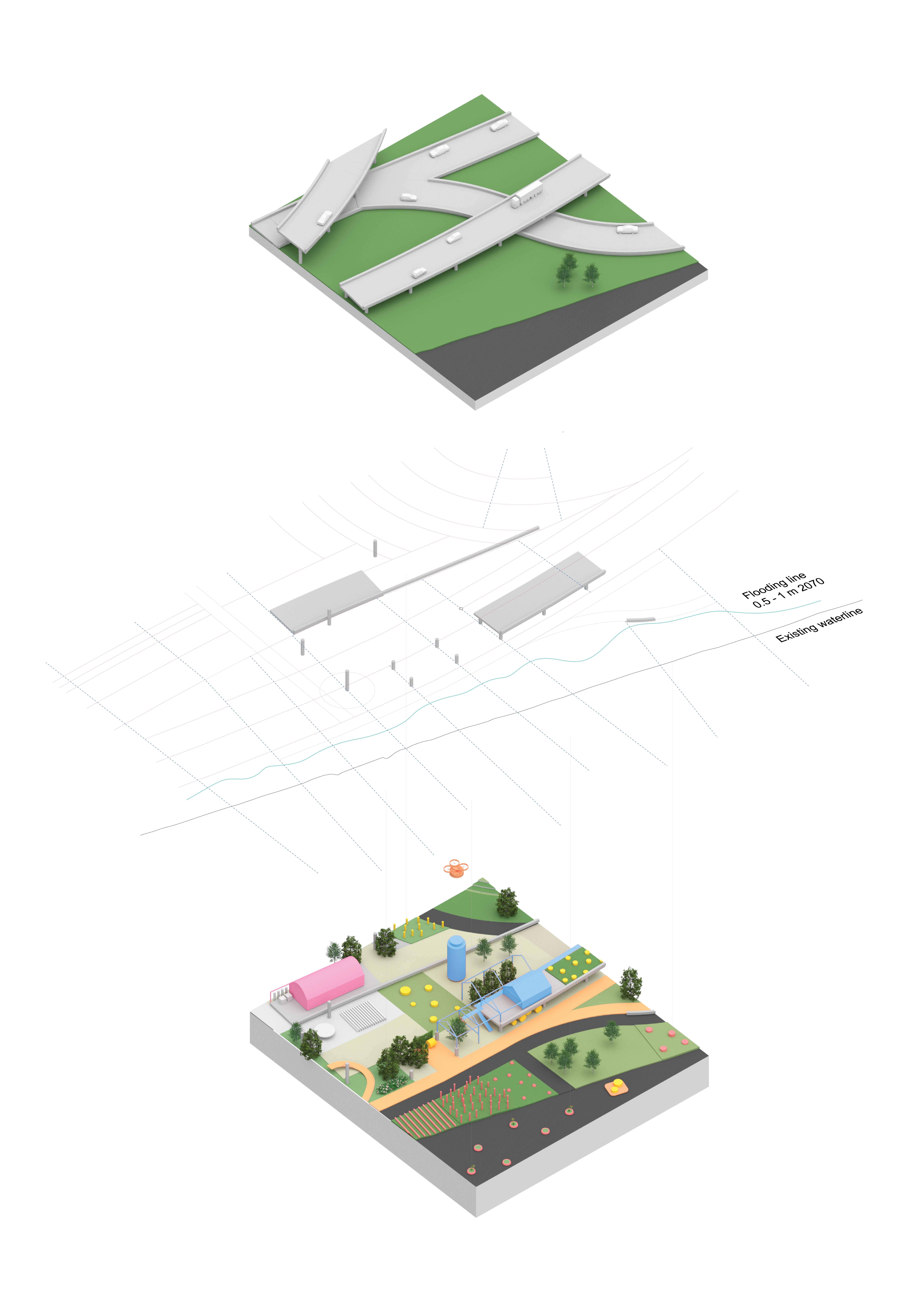
DESIGN APPLICATION
The gained knowledge, transformation strategies and mapping of a local sample site were here combined resulting in a design application. The design application is a responsive hybrid typology hosted on the obsolete infrastructure remains. It aims to carefully restore, regenerate and add value to an urban area were infrastructure were once relentlessly imposed. It’s an investigation of how deconstruction and decay could be the primary catalyzer of change.