REVIVE
Transformation of an industrial landscape
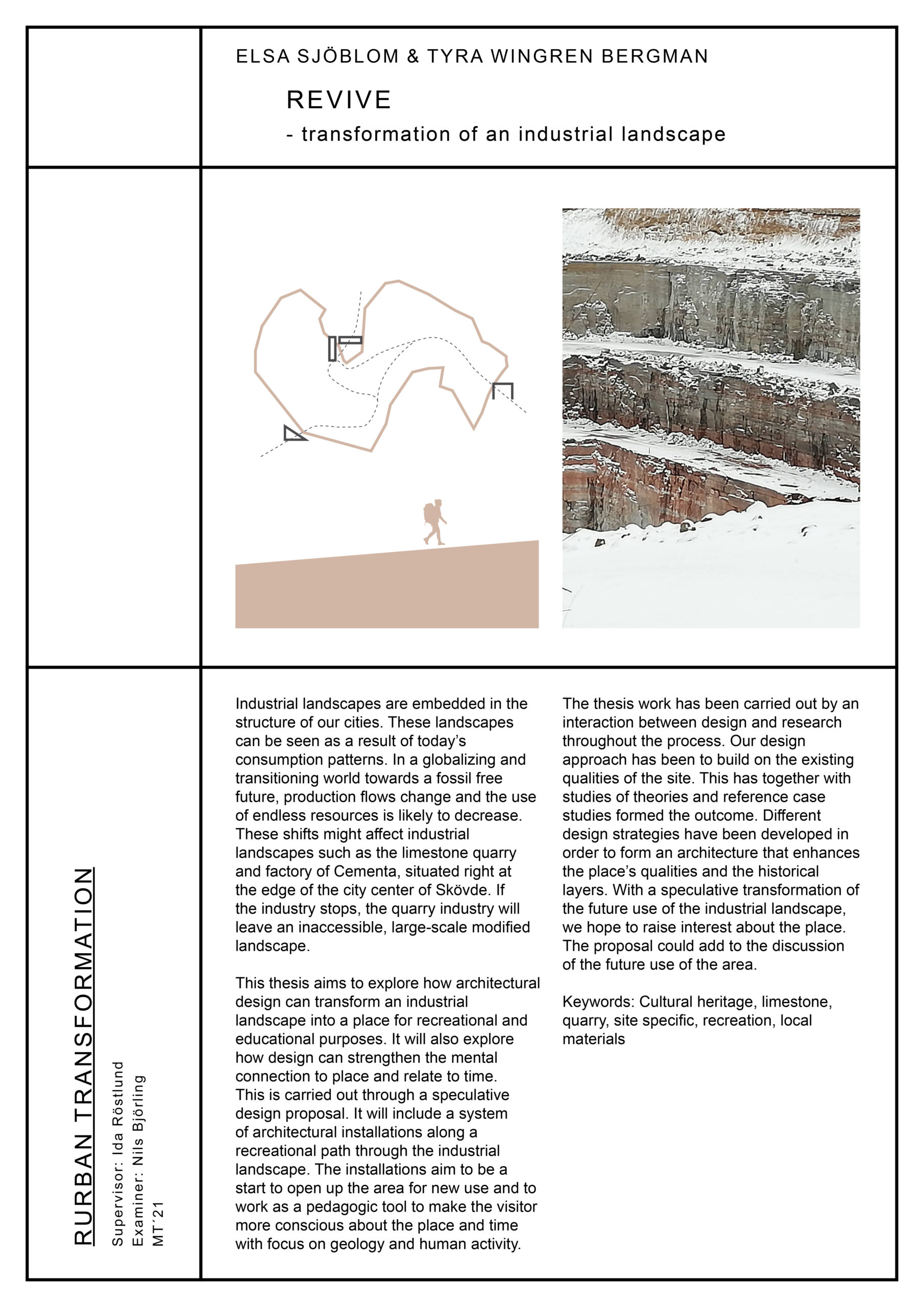
Industrial landscapes are embedded in the structure of our cities. These landscapes can be seen as a result of today’s consumption patterns. In a globalizing and transitioning world towards a fossil free future, production flows change and the use of endless resources is likely to decrease. These shifts might affect industrial landscapes such as the limestone quarry and factory of Cementa, situated right at the edge of the city center of Skövde. If the industry stops, the quarry industry will leave an inaccessible, large-scale modified landscape.
This thesis aims to explore how architectural design can transform an industrial landscape into a place for recreational and educational purposes. It will also explore how design can strengthen the mental connection to place and relate to time. This is carried out through a speculative design proposal. It will include a system of architectural installations along a recreational path through the industrial landscape. The installations aim to be a start to open up the area for new use and to work as a pedagogic tool to make the visitor more conscious about the place and time with focus on geology and human activity.
The thesis work has been carried out by an interaction between design and research throughout the process. Our design approach has been to build on the existing qualities of the site. This has together with studies of theories and reference case studies formed the outcome. Different design strategies have been developed in order to form an architecture that enhances the place’s qualities and the historical layers. With a speculative transformation of the future use of the industrial landscape, we hope to raise interest about the place. The proposal could add to the discussion of the future use of the area.
How can architectural design strengthen
the mental connection to a place and relate to time?
How can architectural design transform and revive an industrial landscape into a place for recreation and education?
Context

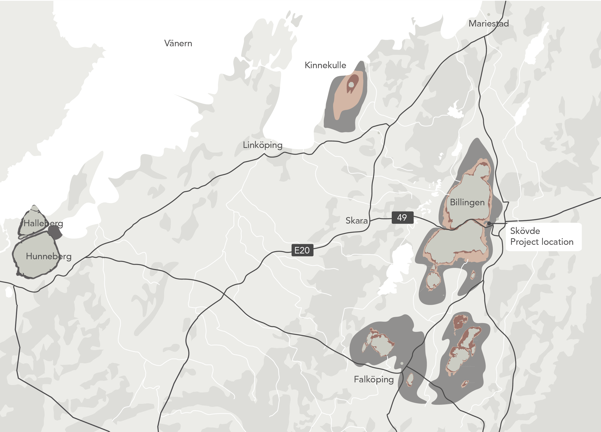
Project location Stone quarry and table mountains in the region
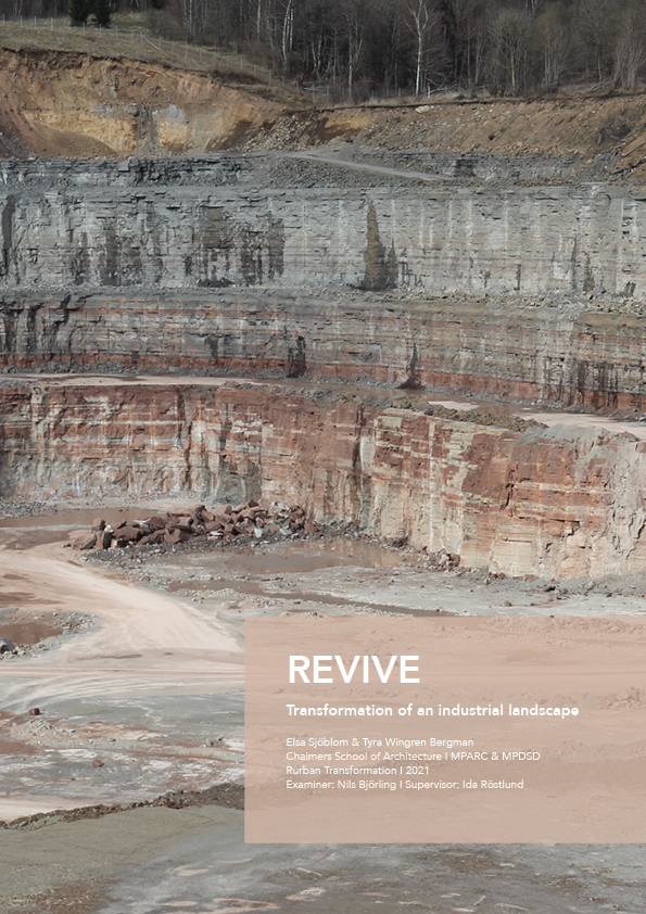
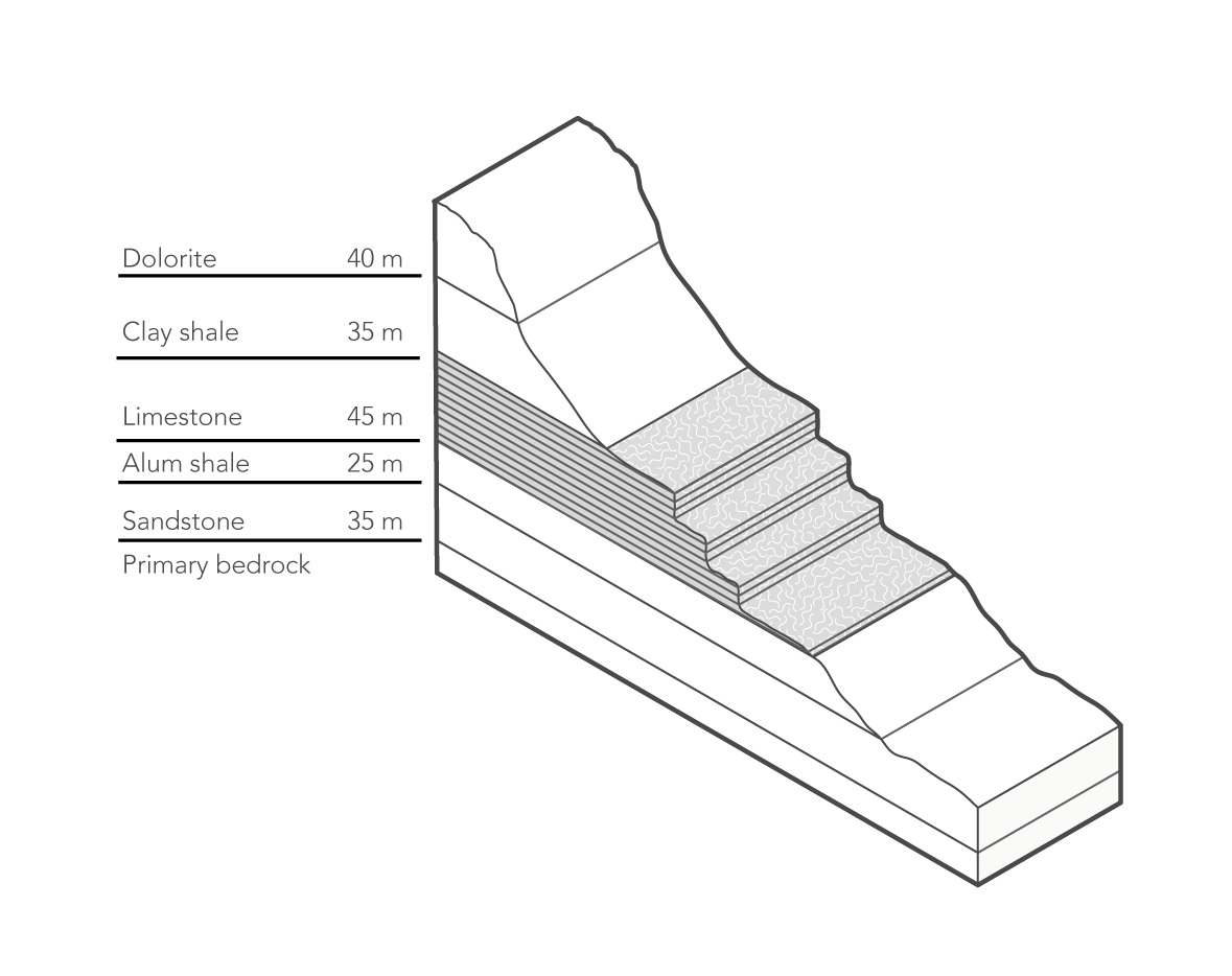
In the region of Västergötland, we find geological phenomenons that are unique. One of them is the table mountains that rise above the plains and are characterized by their flat tops and steep sides. The mountains consist of different stone layers and during millions of years, their top layer of hard dolerite has protected the layers underneath from erosion. The limestone quarry of Norra Brottet is located in between two of these mountains.
The geological time
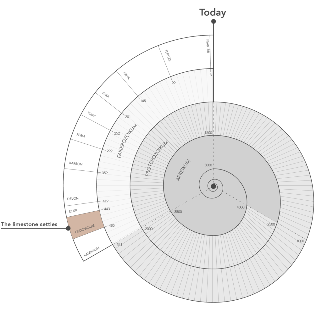
The limestone is of an ordovician age; almost 500 millions years old. That was when our continent was situated south of the equator. In a tropical environment, sediment, like sand, lime, clay and marine skeletons, was deposited at the bottom in a shallow sea. After time, they settled and became rock.
Limestone quarry
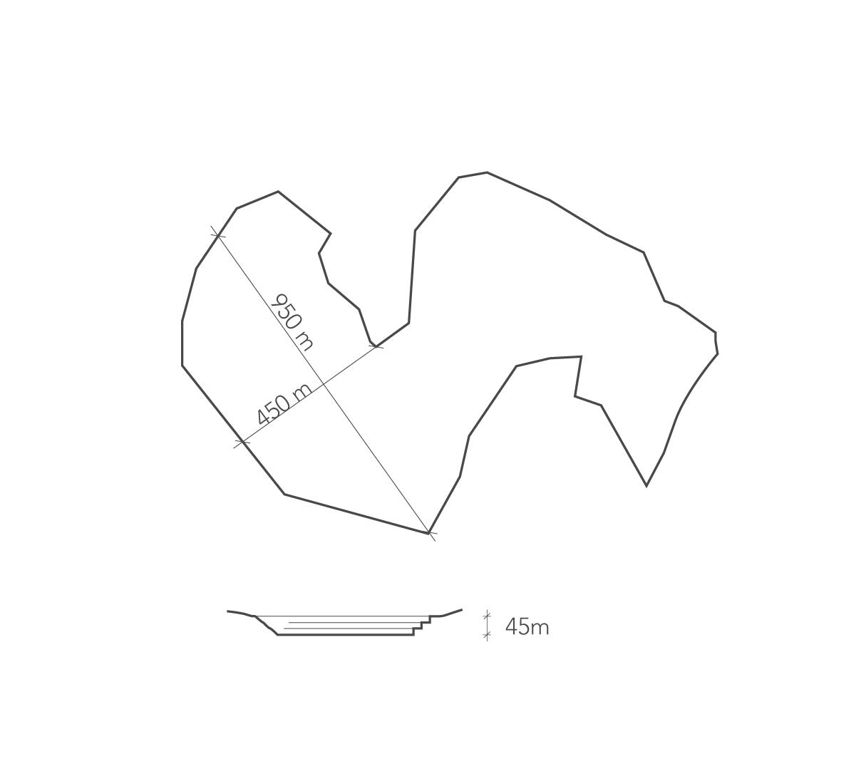
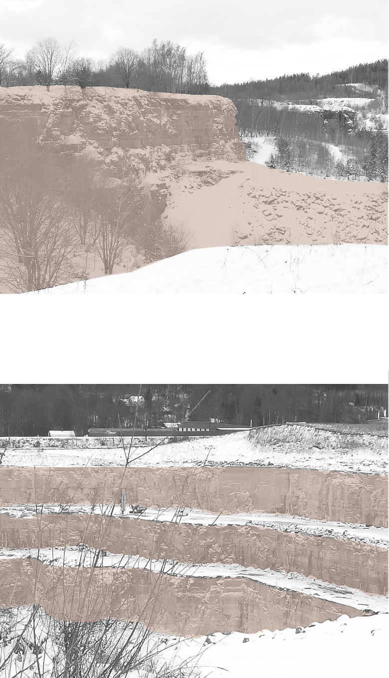
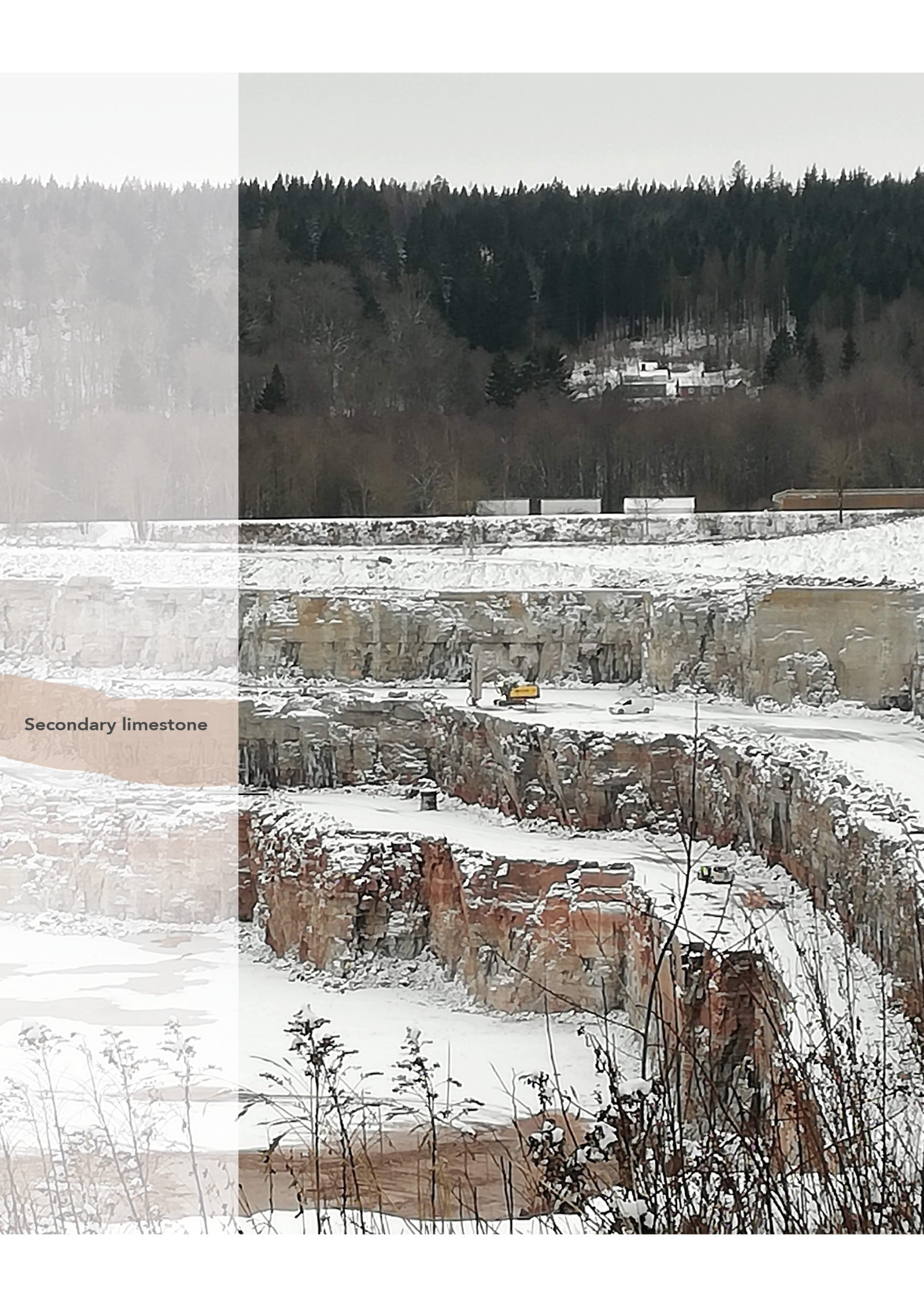
The artificial landscape has different characteristics. The newly quarried parts are strictly leveled, showing the different kinds of limestone in each step. The older parts in the landscape are smoother as a result of the stone walls’ erosion and the growing vegetation. The secondary limestone has been deposited in the edges of the quarry and which contributes to a smoother landscape. Transport roads meander through the landscape.
Factory landscape
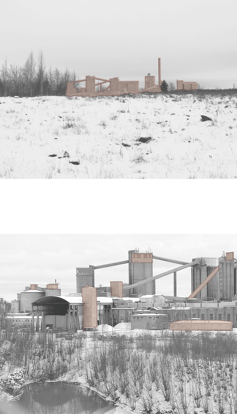
The industrial landscape of the factory is a landmark in Skövde. The massive structures rise high above the city and create a skyline visible from far away. The individual elements are from different ages, all have their specific function and are connected into a megastructure. The low noise and smoke from the factory is present all day.
Rural land
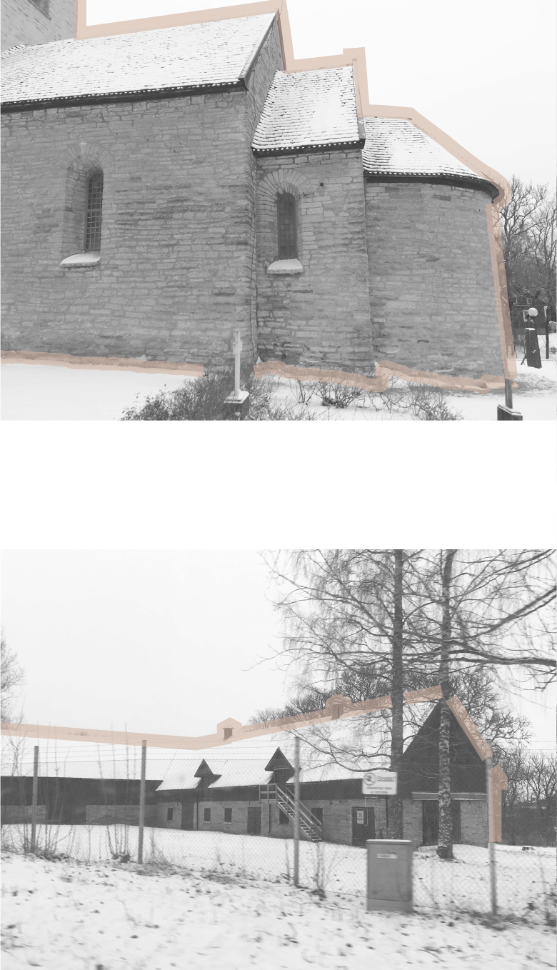
The small medieval village Våmb is situated in the middle of the quarry and by the edge of the factory. In contrast to the industrial landscape, the buildings here are of a small scale, with farms, dwellings and a limestone church from the 12th century.
Village of Våmb (next to the quarry), 1908
The people living here always had a connection to the mountain. The erosion made the ground rich on lime and made it highly productive, which contributed to why people chose to settle here. The mountain provided good access to building material, which can be seen all round the region in houses, churches and structures. And the area has a long history of quarries, lime burning and stone masonries.
Expansion of the Quarry
2031
Stone layers of Billingen
Secondary limestone
The extraction is arranged according to the stone’s different properties, creating giant levels along the edges of the quarry. The middle layer consists of a limestone that has a lower lime content and can’t be used for cement manufacturing. These masses, so-called secondary limestone or “skrotsten”, are extracted and dumped at the quarries edges, to refill parts of the hole, as a part of the aftercare of the quarry.
The limestone is characterized by the traces of remains of ancient animals. The most common seen is the fossils of an extinct squid genus called Orthoceras, whose shell has a long, straight cone shape.
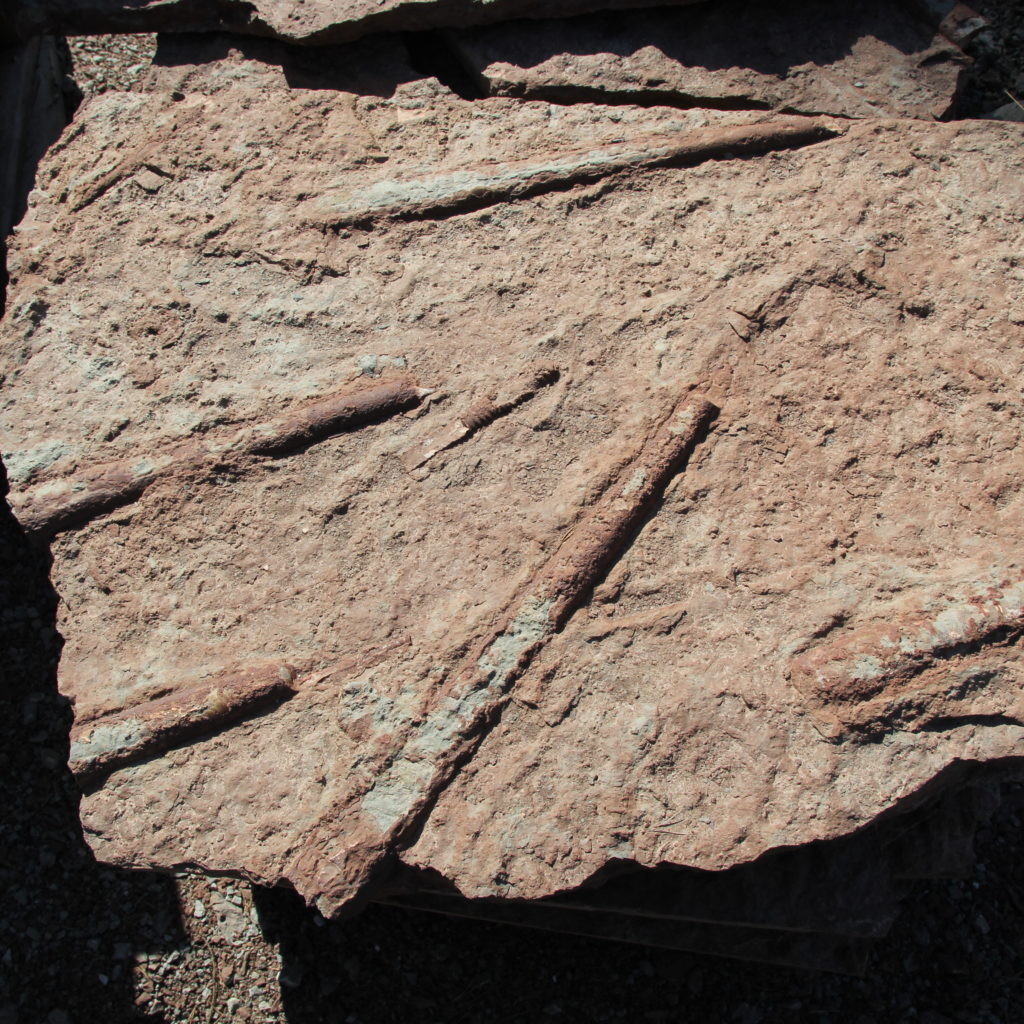
Fossils in limestone, raw surface
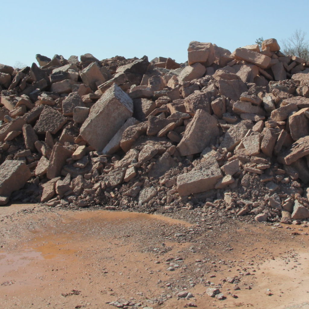
Waste material; secondary limestone
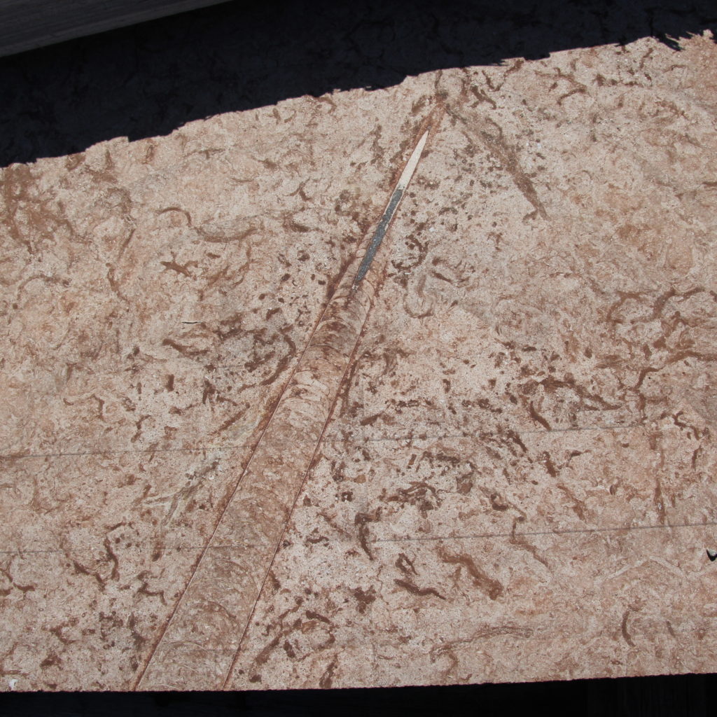
Fossils in limestone, polished surface
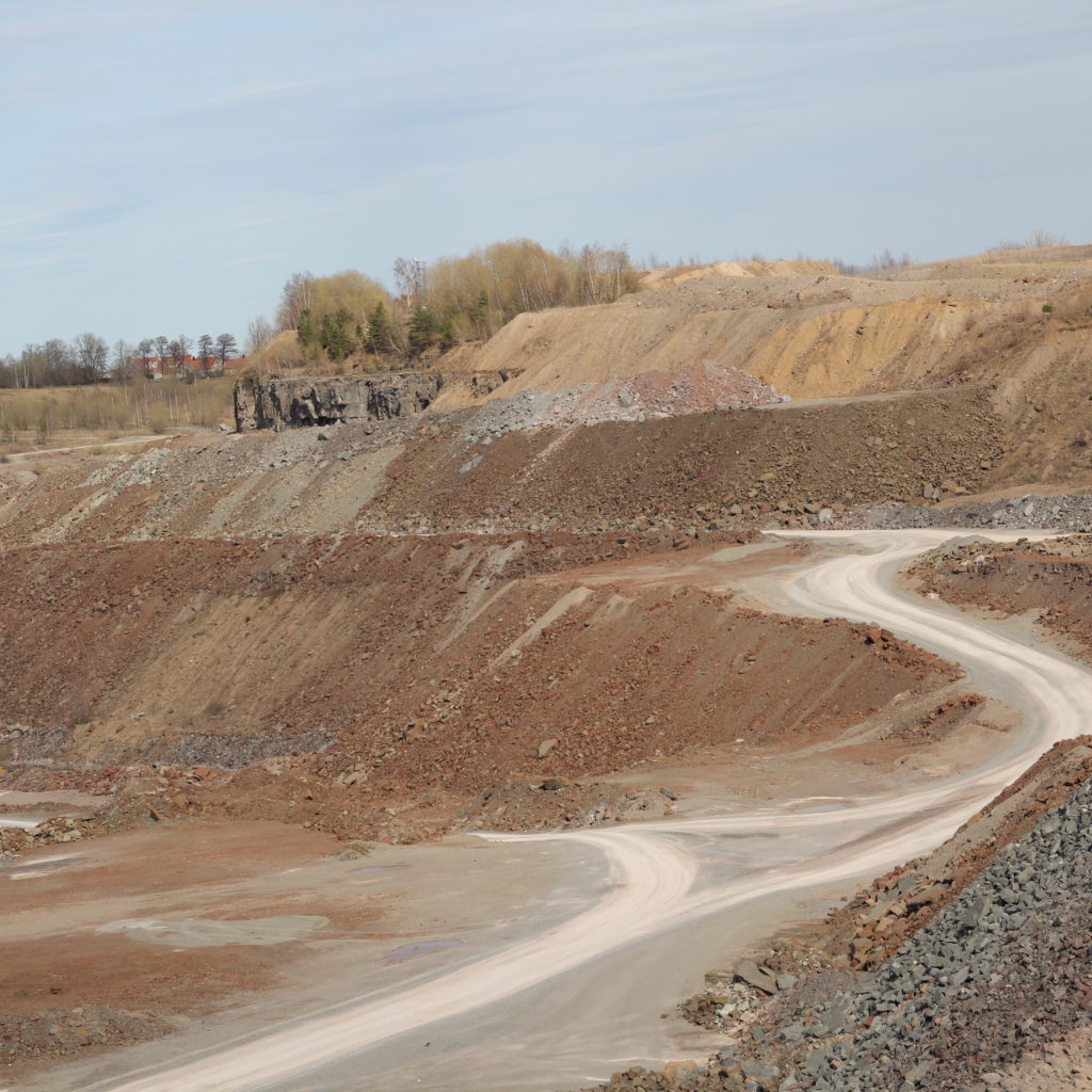
Refilling with secondary limestone at site
Transformation paradigms
How design can relate to time
Difference
Continuity
Cultivation
Optimisation
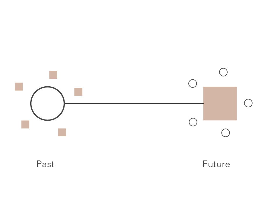
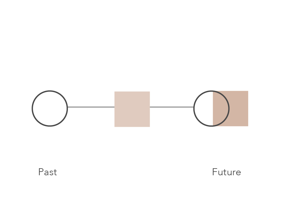
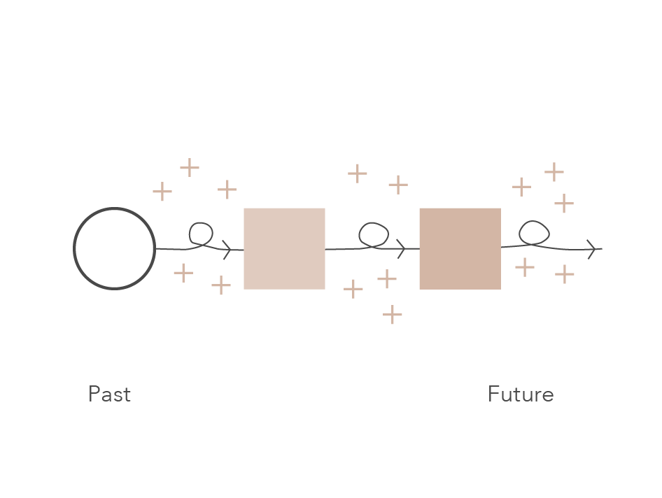
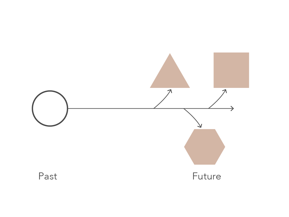
One theory that has guided us in our work is Ellen Braae’s approach to transformation, in which the existing is used as the main driver. The focus is on the creation of a new perspective on the existing, rather than creating something totally new. By the present transformation, a relation to the past and the future can be made. The transformation paradigms show how the design can relate to time in different ways.
Possible futures

2021
The Quarry expands
2031
The Quarry opens up
Future
Change of whole
industrial landscape
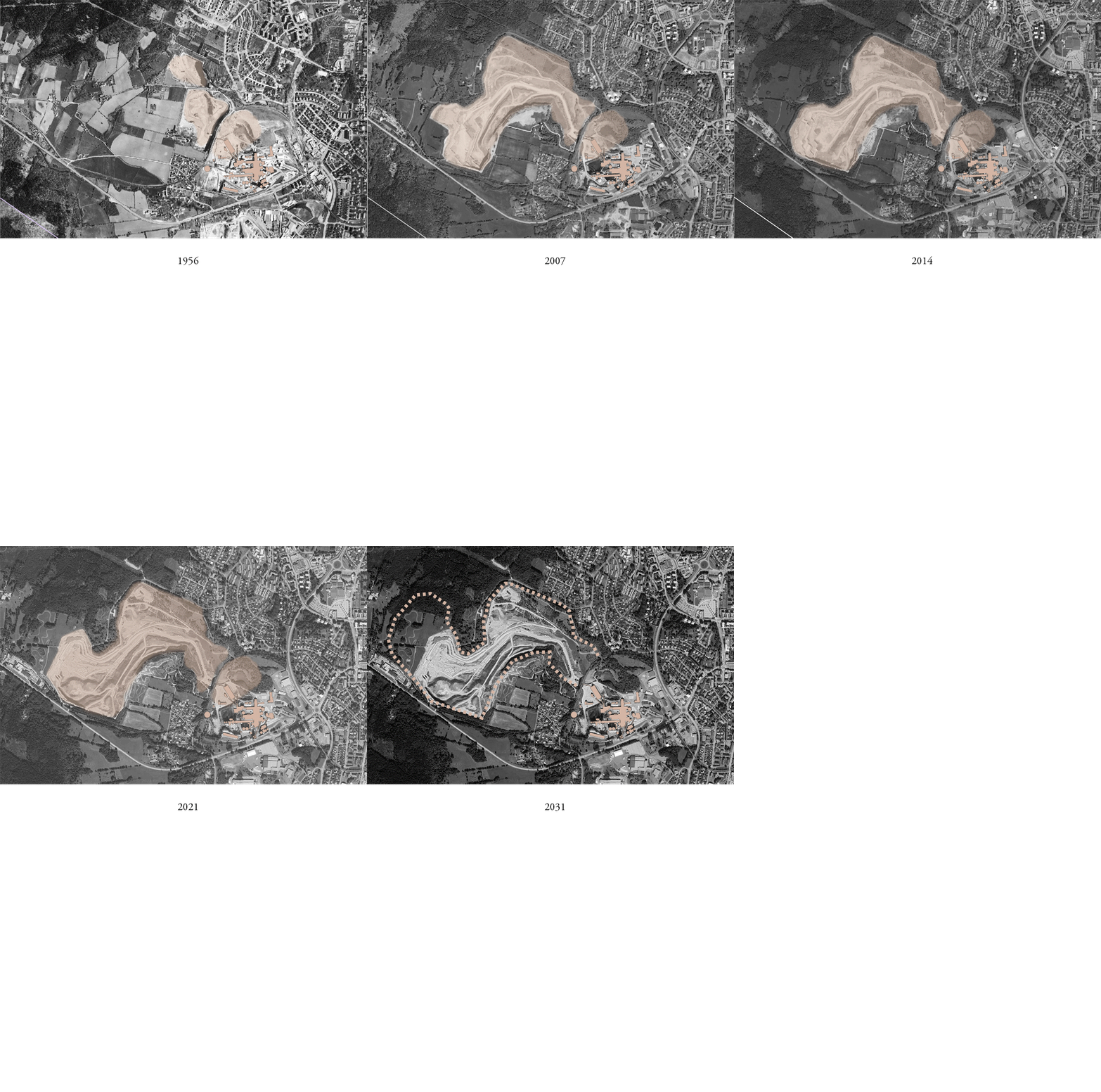
There is a continued demand for cement and the industry remains active for limestone extraction and production of cement. A new application for further extraction in the valley is approved and the industry requires more land, either an expansion further into the valley towards Billingen or to the central parts of Skövde. With this development, the area is not accessible for other purposes.
A new application for further extraction in the valley is denied. There is still a demand for cement and the industrial buildings remain active but use raw material from another quarry. This opens up for a new use of the stone quarry. The proposal takes support in the upgoing trend and interest in recreation life and transforms the stone quarry into a recreational space that educates about the local context.
In the third step, the industry and quarrying stops and a new application for further extraction into the valley is denied. Both the quarry and industrial buildings can open up for new use. The industry could make a transition into a more sustainable production. The industrial landscape with buildings and quarry has many existing values to build further on. They can be seen as a resource in terms of reusing a structure and have a cultural value that tells a story about the past and let it continue and transform into a new use in the future.
Design installations
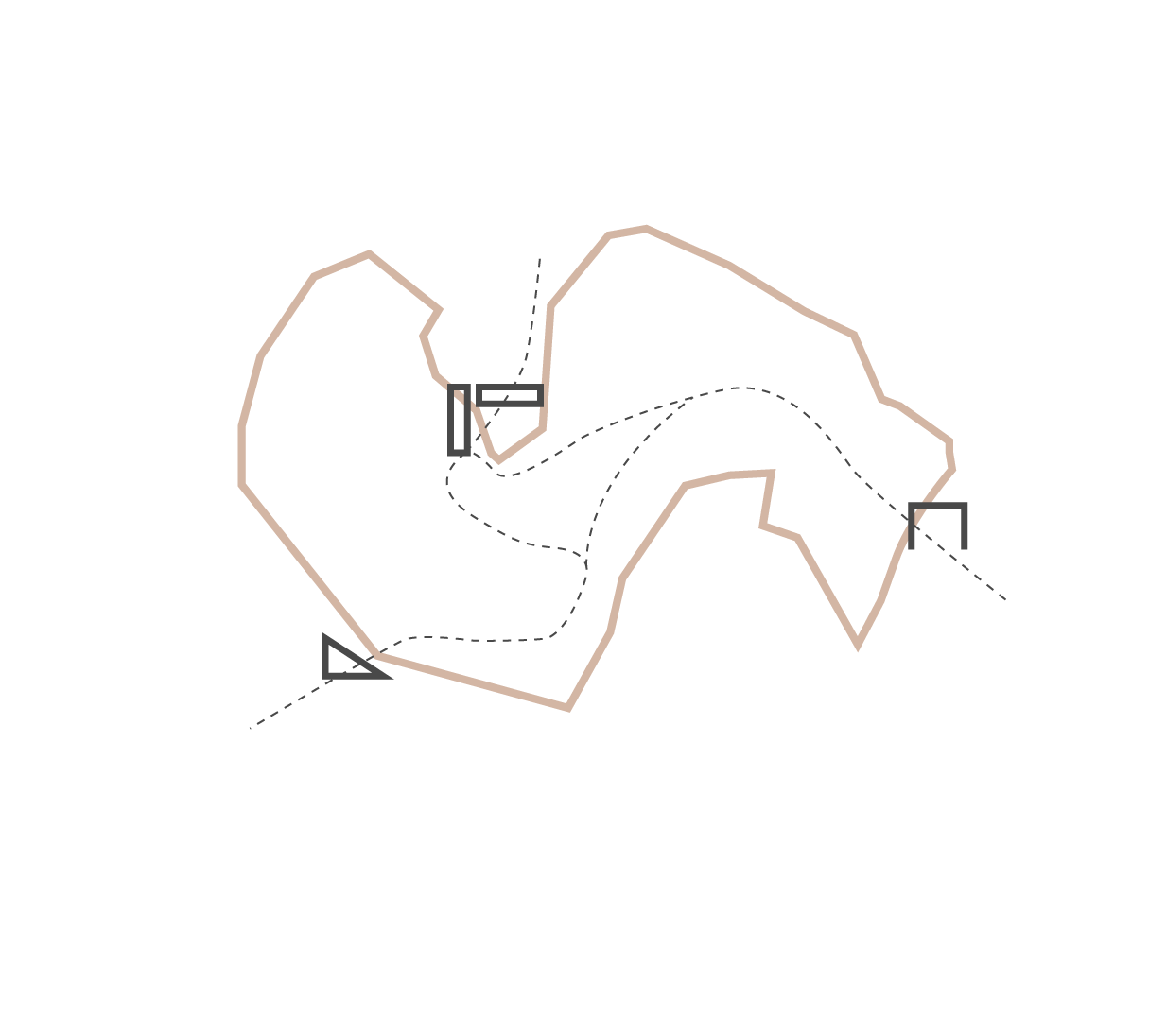

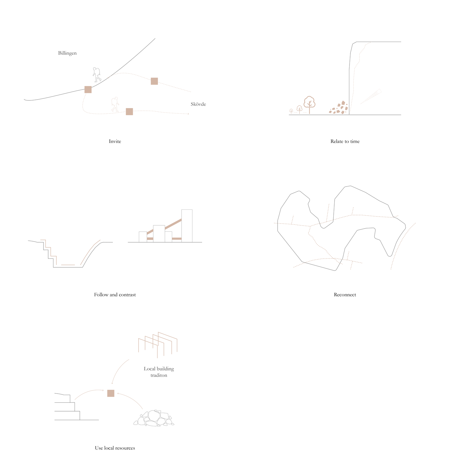
The design installations are influenced by their immediate context in relation to view directions and terrain, in order to enhance the qualities of the place. The installations that are differentiated in activities, are linked through a path in the industrial landscape.
Design strategies
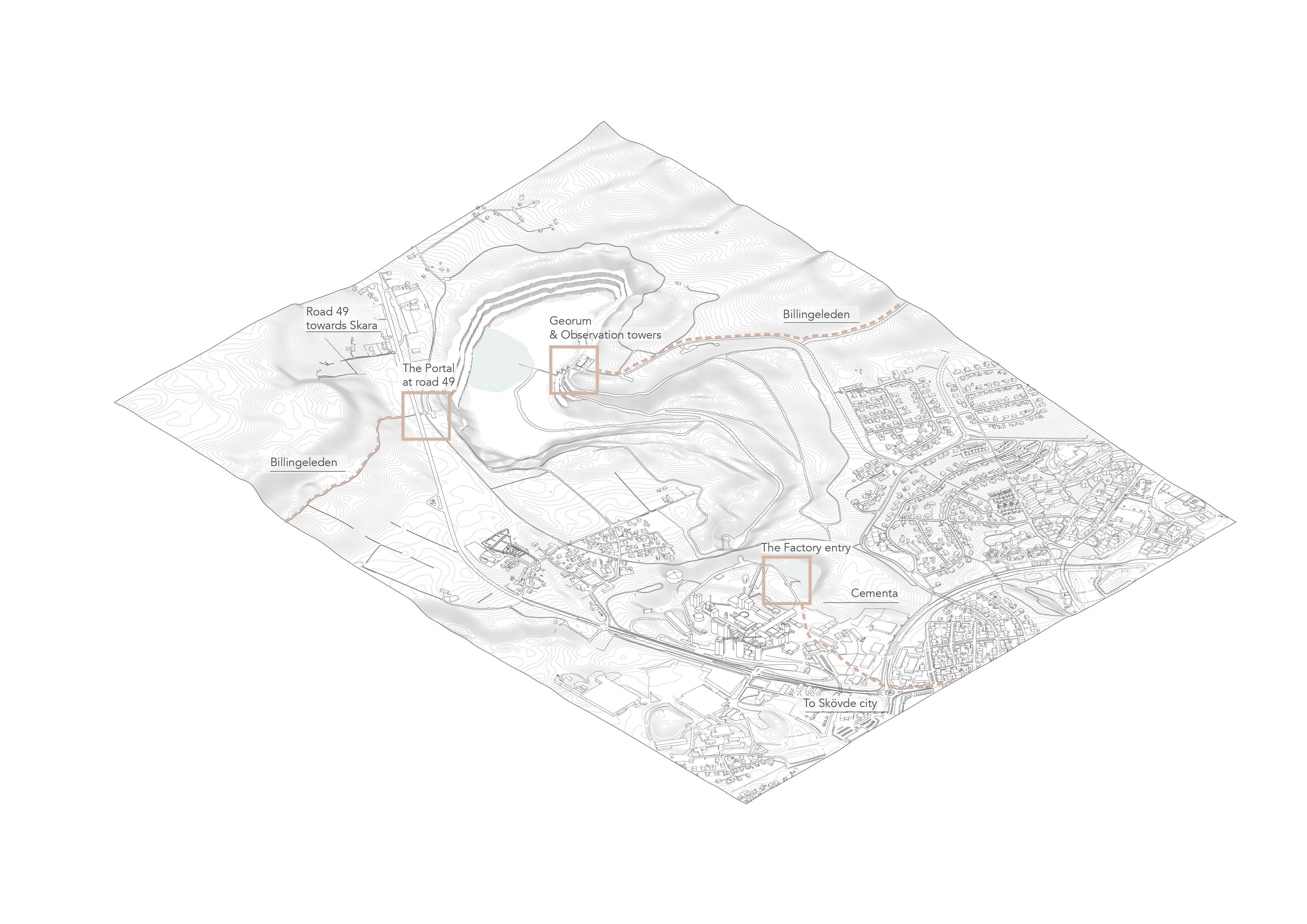
Location of design installations
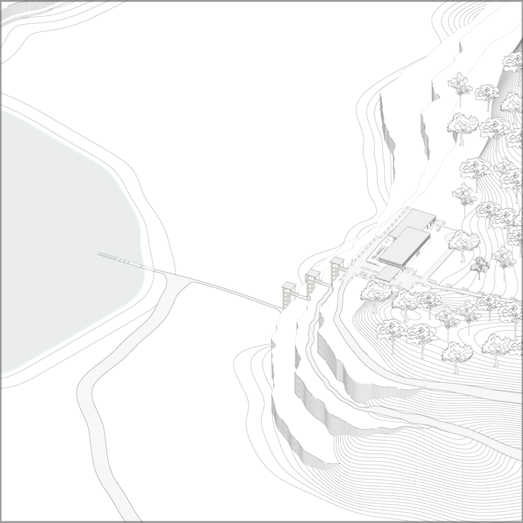
Georum & Observation towers
The Portal at road 49
The Factory Entry
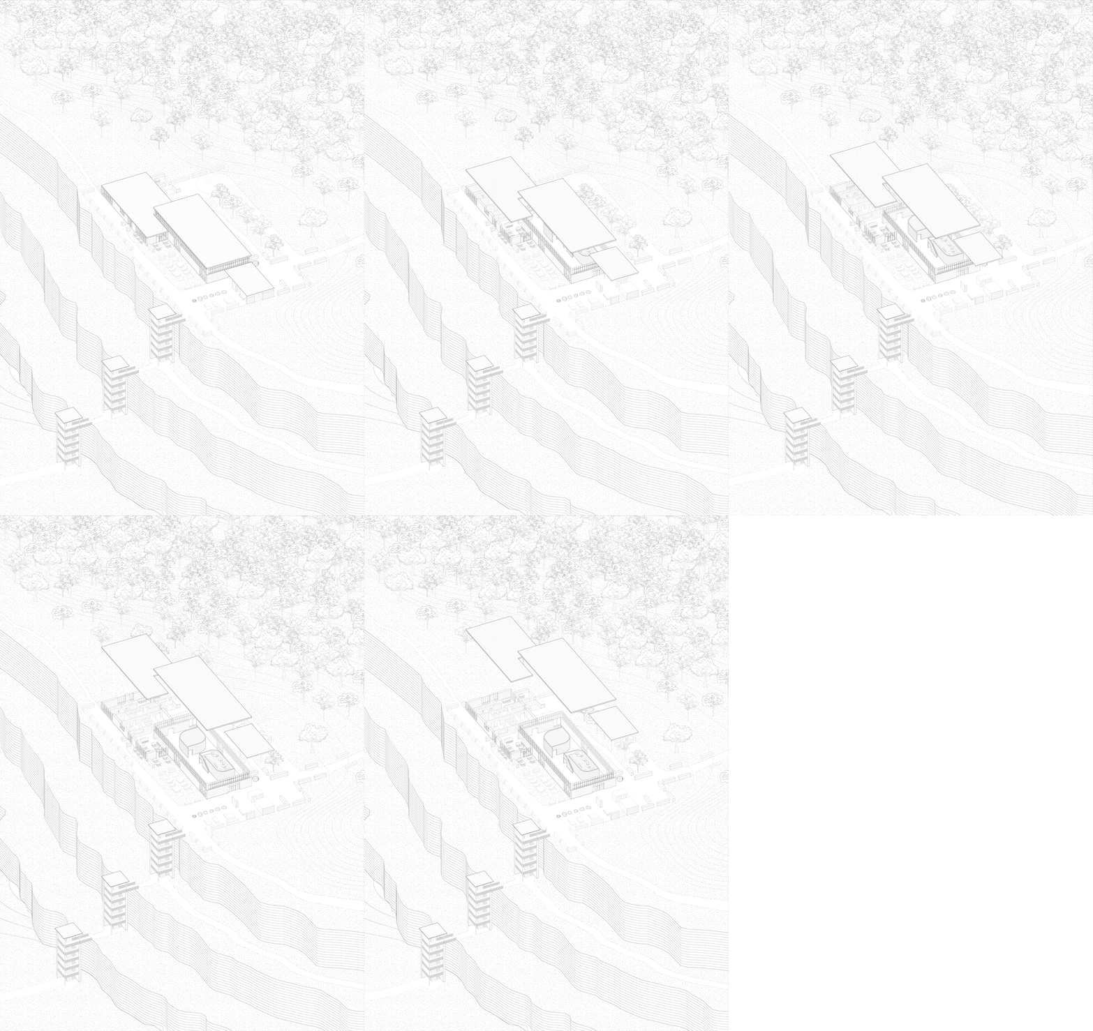
The visitor center is situated on the top of the quarry where an old road ends in a steep cliff. The installation connects the stone quarry and Billingeleden.
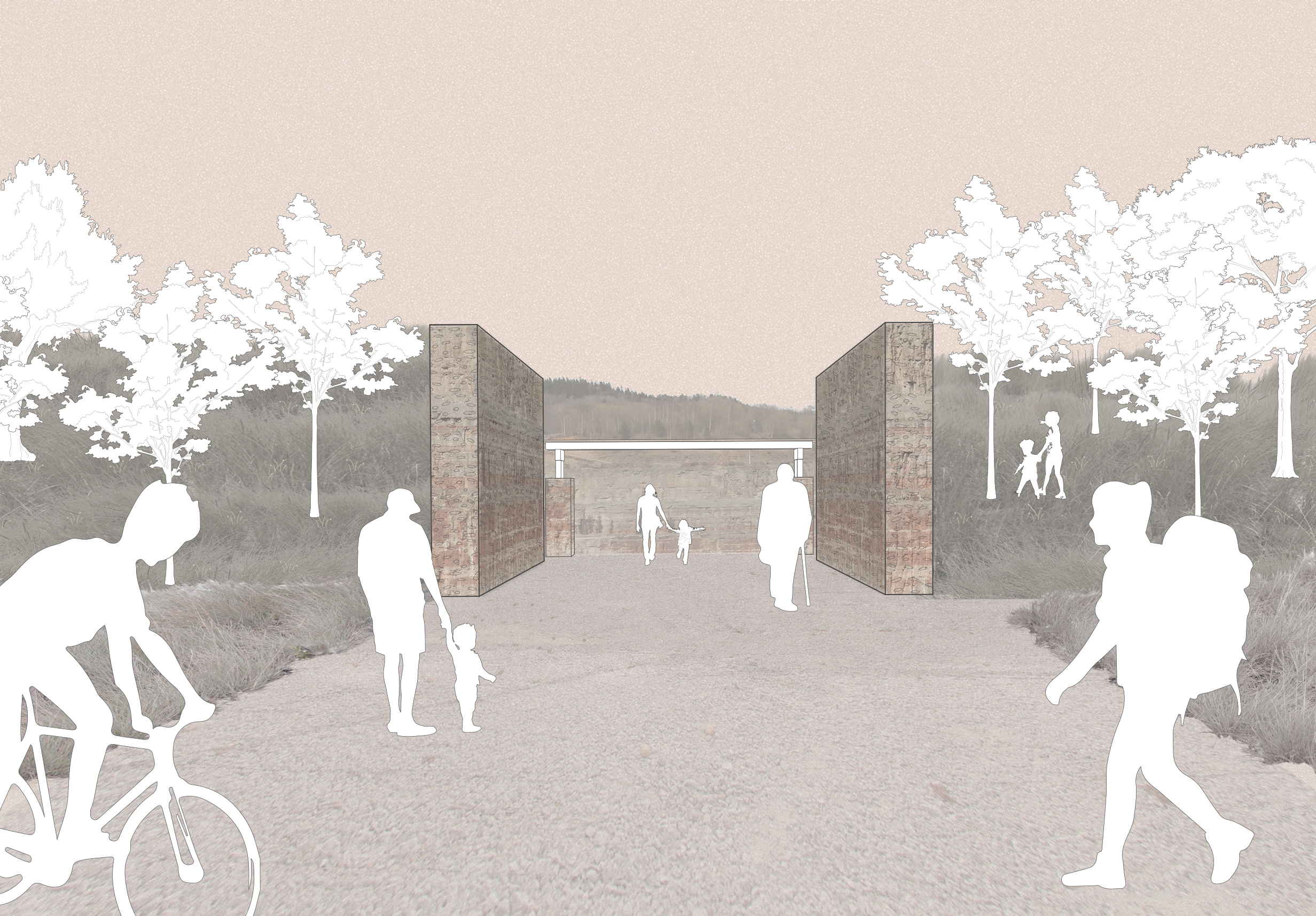
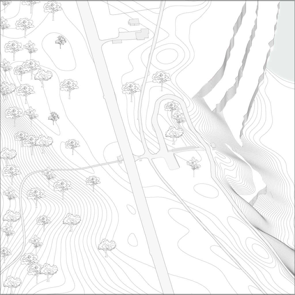
The portal connects to the quarry and the hiking path Billingeleden. The installation cuts through the hillside which enables travellers on road 49 to notice and experience the quarry.
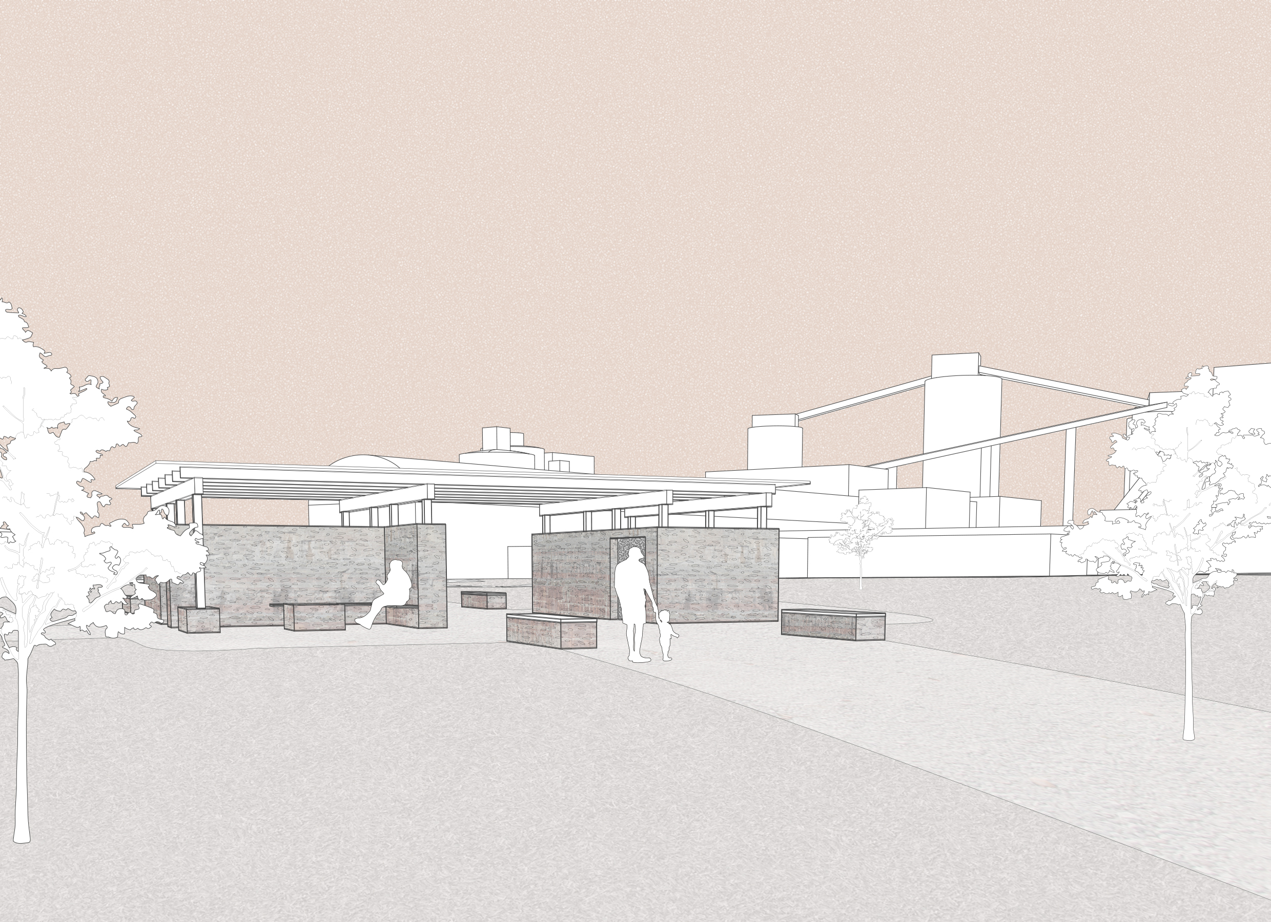
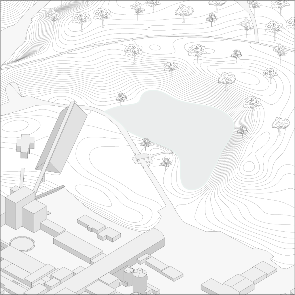
The entry ties the stone quarry to the city center of Skövde. The installation frame views towards the factory landscape and towards the remains of the first areas that were quarried.
The Visitor center: Georum
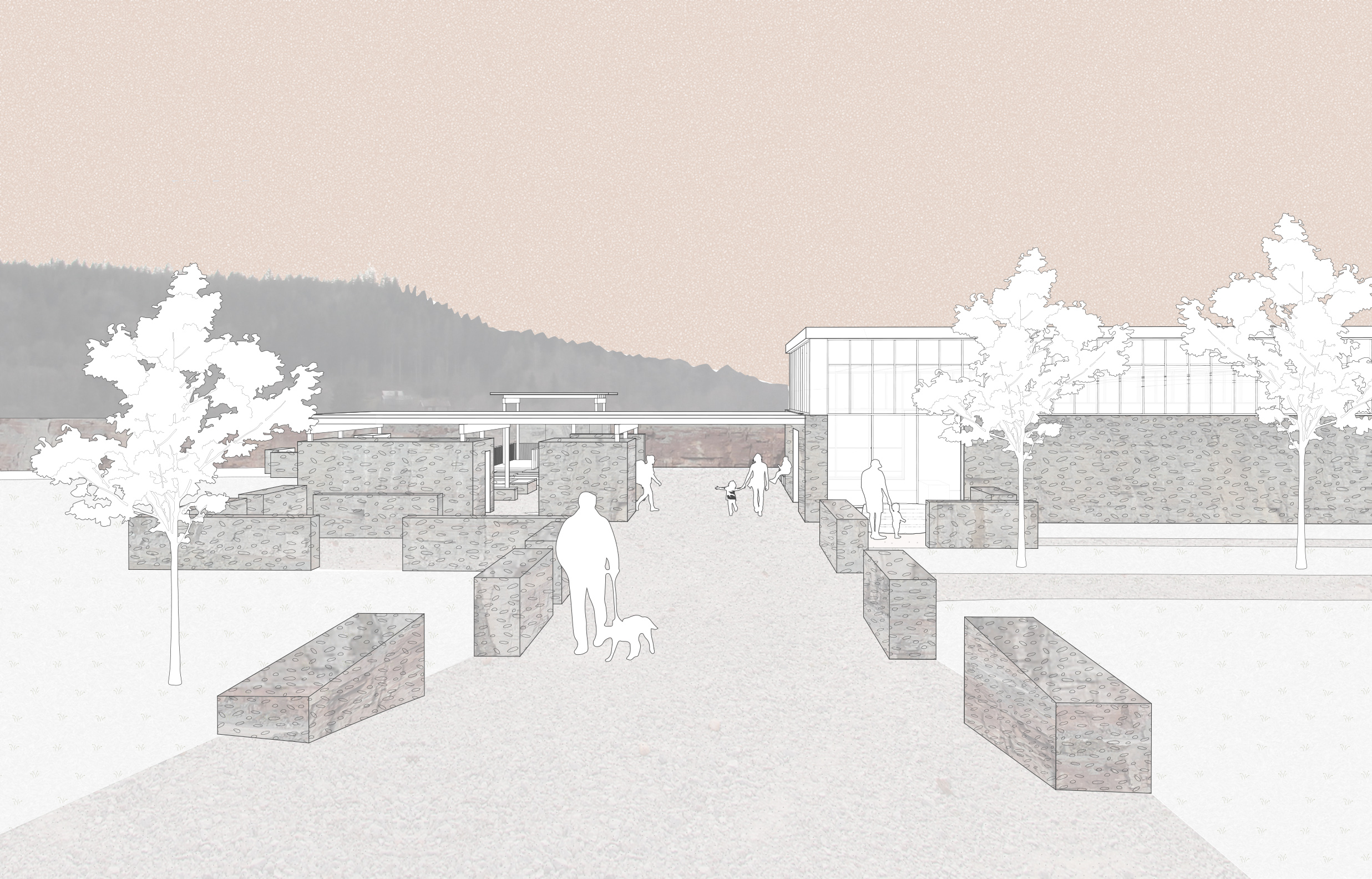
The visitor center, with the components Georum and the observation towers, is situated on the top of the quarry, where an old road ends in a steep cliff. This is the largest design installation and should be an attraction to explore the quarry. It is located strategically next to Billingeleden. The building has an elongated shape in the direction of the quarry. The division of the volume creates a portal to the quarry from the road. From this point, the visitor could enter the indoor exhibition or continue through the outdoor exhibition, into the quarry landscape. The division of the volume also enables spaces that could offer better microclimates at an exposed site, suitable for seating areas. Semi high limestone walls also contribute to this. The whole building should work as an exhibition space to experience geology and history of human activity. The outdoor exhibition and observation towers are open around the clock and make the place active when the indoor exhibition is closed.
Observation towers
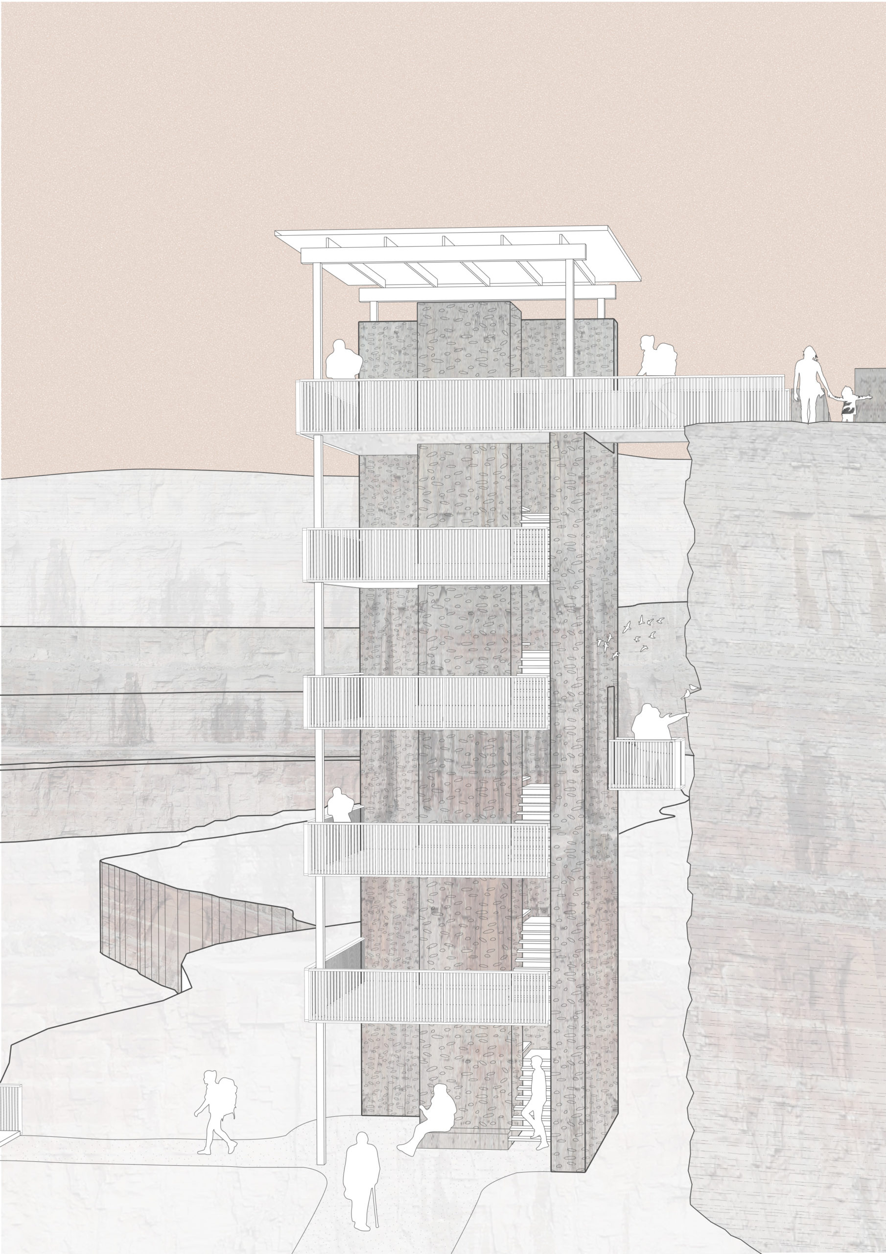
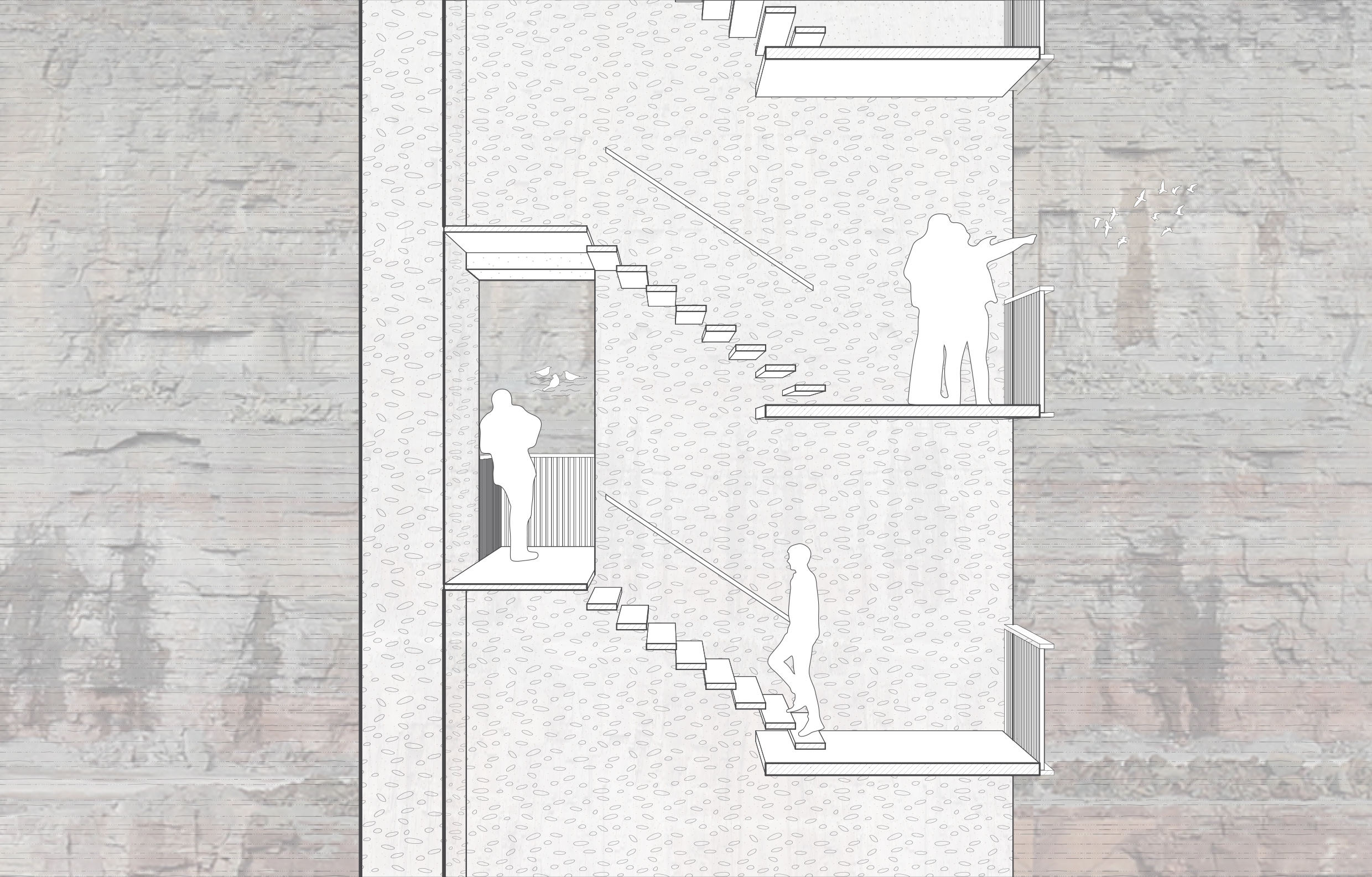
The observation towers are open for visitors at all times and with stairs and elevators the visitor can access the quarry. At the platforms, there are exhibition spaces from where the visitor can learn about the place’s history connected to the quarry landscape. The massive walls of secondary limestone have openings at some places to frame the quarry cliffs. Here, the visitor can experience the rock and the wildlife at a close distance.
The Path
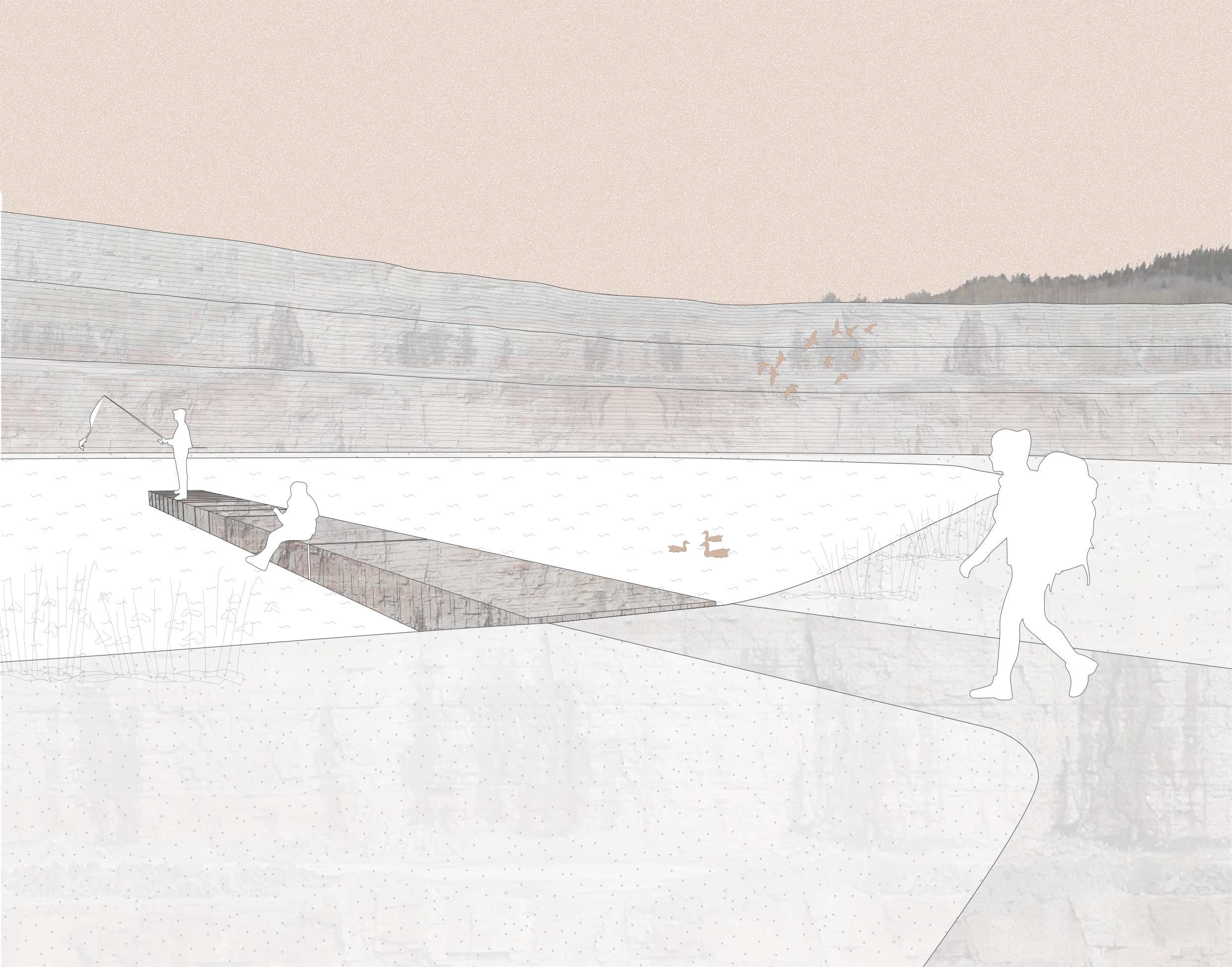
One of the elements along the paths is situated next to the lake. Today the water is continuously pumped out of the quarry. If the quarring ends, the water will be kept in order to create a richer biodiversity. According to the aftercare plan, the water level is going to be around 1 meter at the time of 2031 but will alternate throughout the seasons. The path connects to an installation of limestone blocks that extend into the water. The small-scale bridge could enhance the feeling of the large quarry. The blocks also act as a reference point as the water level will differ throughout time.
The Portal at road 49
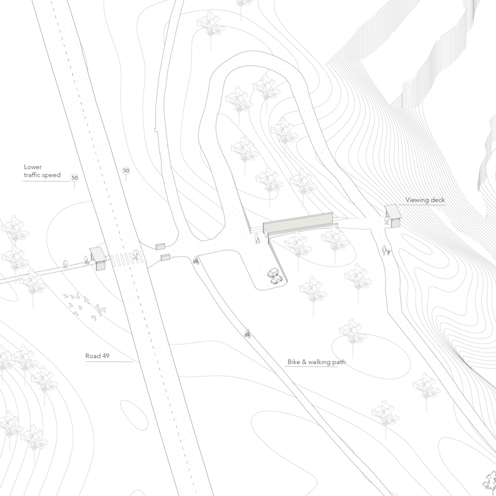
Today, a small hill acts as a barrier between the road 49 and the quarry landscape. In this installation, the connection between Billingeleden and the quarry is strengthened by stone walls extruding into the hill in order to access the quarry and the viewing deck. The walls continue in a similar way on the other side of the road. Through time the vegetation will gradually take over and transform the today’s rocky slope to a green hill and the design will contrast even more.
The Factory entry
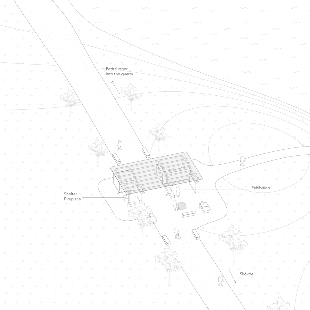
This installation is situated on the transport road that connects the factory to the quarry. It works as an entrance to the industrial landscape. If the quarrying stops at Norra Brottet, the road could be adapted into a hiking path in order to connect the central parts of Skövde and the quarry landscape. The factory could remain active with material extracted from other quarries. At the installation, the visitors can observe the factory landscape and visit the exhibition space. The two seating areas with fireplaces frame views towards the factory and a small lake, that is the remains of the first areas that were quarried, in the beginning of the 1900s.
Future potentials
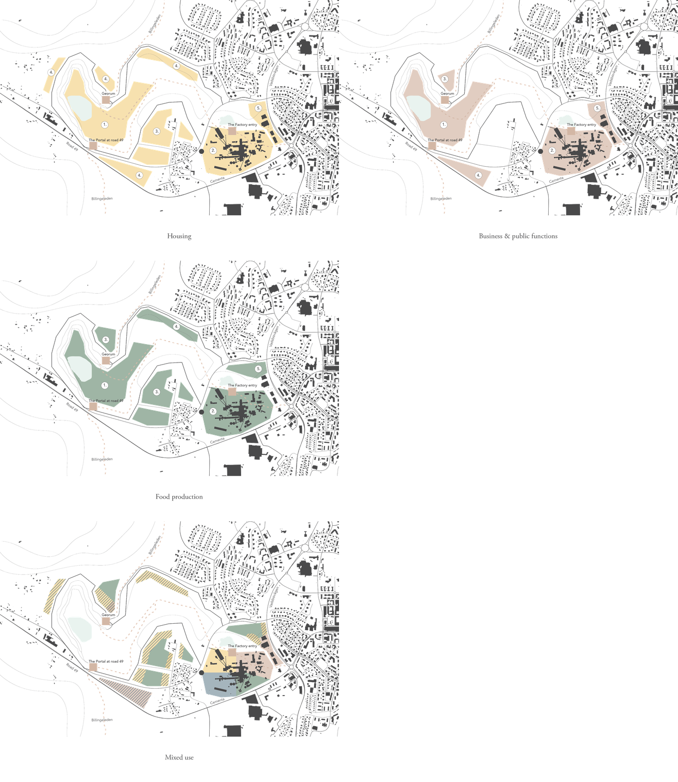
With the quarry being more open to the public, it could regenerate other future potentials of the whole industrial landscape. This is discussed in relation to the main proposal and was a way for us to develop the proposal so that it is open for change. This is tested with possible establishment of functions such as housing, businesses and production of food and energy. In this elaboration, we also involve the factory buildings and speculate about their future use. Four themes are discussed separately and then merged into one proposal that we look more closely on now.
The industrial landscape is here developed into a mixed use neighborhood where functions are combined to use the land efficiently and create a more resilient neighborhood, where functions can sustain each other and create synergies. Different functions would activate the area during many seasons and hours of the day. The aim has been to find a balance between future needs and to be able to see traces and understand the past of the place.
Contact
elsasjoblom@gmail.com – tyra.wingrenbergman@gmail.com
